…and my Bembridge, Isle of Wight, Flying Adventure.
Last time I posted an article in this series was in 2020, in the midst of the Covid pandemic. The article was about G-VIZZ, the Sportavia/Fournier RS-180 Sportsman aircraft that I and a number of friends owned as a syndicate.
Sadly, we no longer own that aircraft. Since she was the only British-registered example of the aircraft, of which indeed a total of only eighteen! airframes were ever built, she was really expensive to maintain for various reasons, not least of which was the cost of spare parts, her age, and all this as well as our being a captive market to the very few specialist engineers in the country who were actually certified to service her.
And so, we sold her[1]. But, from the figurative ashes of our syndicate arose an even more beautiful flying experience.
Because we decided to build our own aircraft.
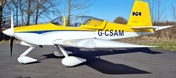
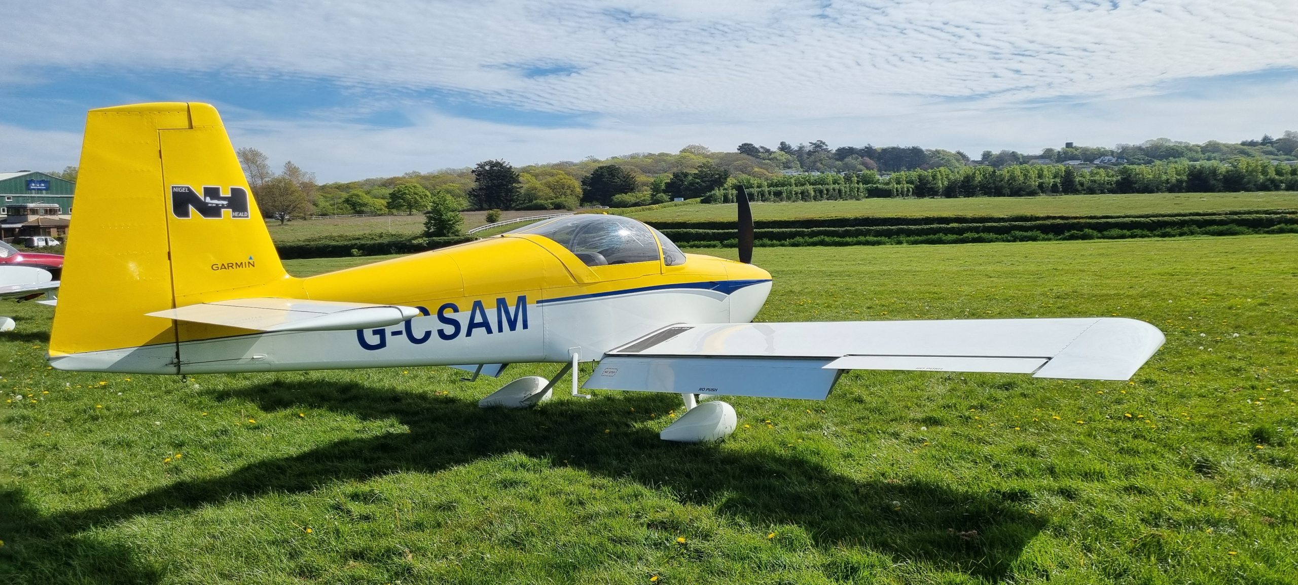
Allow me to introduce Alpha-Mike[2], a Van’s RV-9A[3]; a ‘kitplane’ aircraft of a class known as a ‘homebuilt’. The idea is that you get a series of boxes (very much like a giant Airfix kit), and a little tube of glue, and you build yourself an aeroplane in your garage 😉 Of course, it’s not quite like that, but essentially it’s that any halfway-competent engineer, including people who have learned basic car servicing and repairs and whatnot, anyone like that can build an aeroplane for themselves. They are less expensive to buy than an already-assembled plane[4], and you can customise the aircraft to your heart’s content as you build it.
Once it’s built, you then get in a qualified engineer from the UK’s ‘Light Aircraft Association‘ (the LAA), who checks your work for you. And then he gets in the aircraft, complete with his nerves of steel[5], and takes it for its first test flight. Wow, that takes some guts!
On an ongoing basis, then, we now do all our own servicing and repairs, and we have Alpha-Mike’s ‘Permit to Fly’ reissued (after an engineer inspection) once per year. Think of the Permit to Fly as being like an MoT test, if you will; it amounts to the same thing.
The aircraft is owned by Nigel, one of the former G-VIZZ syndicate members. Members of the group (we can’t really think of it as a syndicate because we don’t jointly own the aircraft) can fly her whenever they please. We even have a proper booking system. And this is the cheapest powered flying I have ever had, by far, so I can afford to fly more often[6].
And what flying! I’m going to get on with the main article now, and showcase this lovely aeroplane which is so much better in every way than any other aeroplane I have ever flown[7]. I’ve previously written about the Piper Warrior, the Cessna 152, and the RS-180; all aircraft I have flown on a regular basis. But the RV-9A is in a different league entirely.
(All the images in this essay are zoomable by simply clicking on them)
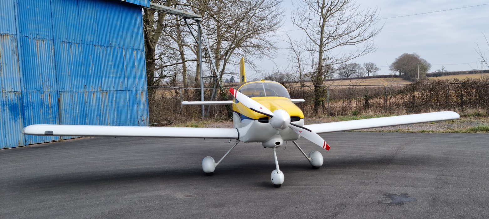
The RV-9A, like all of the aeroplanes I have flown – well, the powered ones, at least[8] – is a single-engined monoplane light aircraft, powered by an Avco-Lycoming engine. In Alpha-Mike’s case, the engine delivers 160hp of power to an aircraft with a maximum all-up weight of 970kg, as compared to the RS-180’s 180hp for 1100kg, or the Piper Warrior’s 1055kg powered by a 160hp engine, so there’s a fair difference in power-to-weight ratio.
Added to that, the clean airframe design, small forward profile (as you can see in the above photo) and optimised wing profile and even a ceramic coating, means that Alpha-Mike is a bit of a ‘hot ship’. She does 140kt[9] in the cruise – that’s about 160mph – and has an excellent fuel efficiency.
This is also, to a large extent, because she has a variable-pitch (VP) propeller. Unlike all the other aeroplanes I have flown, where the propeller blades have a fixed pitch (the angle they are set at on the propeller spinner), a VP prop can vary its pitch so that it makes it more efficient, taking a bigger or smaller ‘bite’ of the air with each revolution according to how it is set. This works in a very similar way to the gears on a car, so that it doesn’t have to stay in first gear all the time, but instead it can be set to lower RPM (and therefore using less fuel) if required. In fact, Alpha-Mike has a flight endurance of something like 4.5 hours on full tanks, assuming correct leaning of the mixture[10] and judicious use of the VP prop. So, not only is she fast but she’s efficient too[11].
So, we built her ourselves, then. Here’s a picture of her in her original hangar, where we did most of the work.
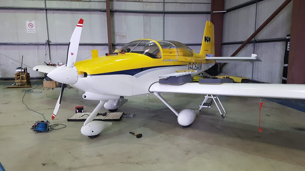
As you can see, we found the upper wing surfaces to be a very handy place to put all the tools and other bits of the stuff we were working on 😉 and she is pretty much complete in this photo, which was taken the day before her maiden flight. Once we’d shifted all that clobber off the wings, and reinstalled the left seat, we took her over to the fuel pumps to fill her up.
We had already done test runs on the engine, we’d calibrated various items like the ‘magnetometer’, which basically does the same thing as a compass, and so we got the brave engineer out to have a look.
Once he’d signed her off, he took her for her first test flight. Here it is, in all its glory:
Immerse yourself in the aviation vibe for this clip: the air-to-ground communications (we had an airband radio monitoring the Tower frequency), and the raw emotion in the voices of the observers. There was a whole group of us there; most of the people who had had a hand in her construction (about eight of us) were present for this maiden flight. You can hear someone near the end of the clip saying ‘Congratulations, Nigel’, and quite right too.
So, we had a brand-new Van’s RV-9A to play with!
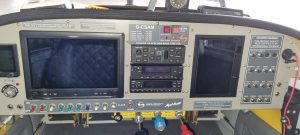
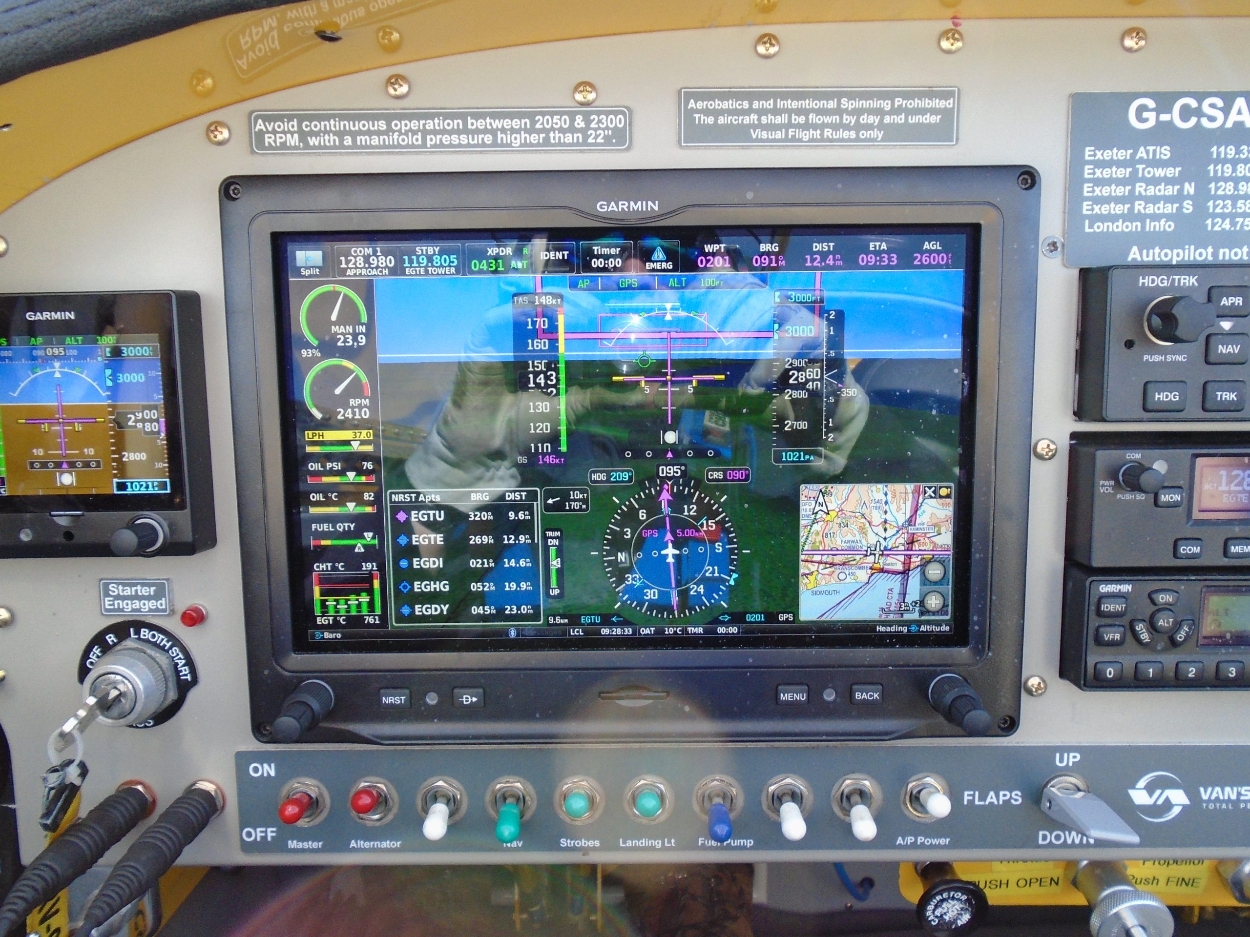
Here is a photo of her instrument panel as it was just after construction was complete:
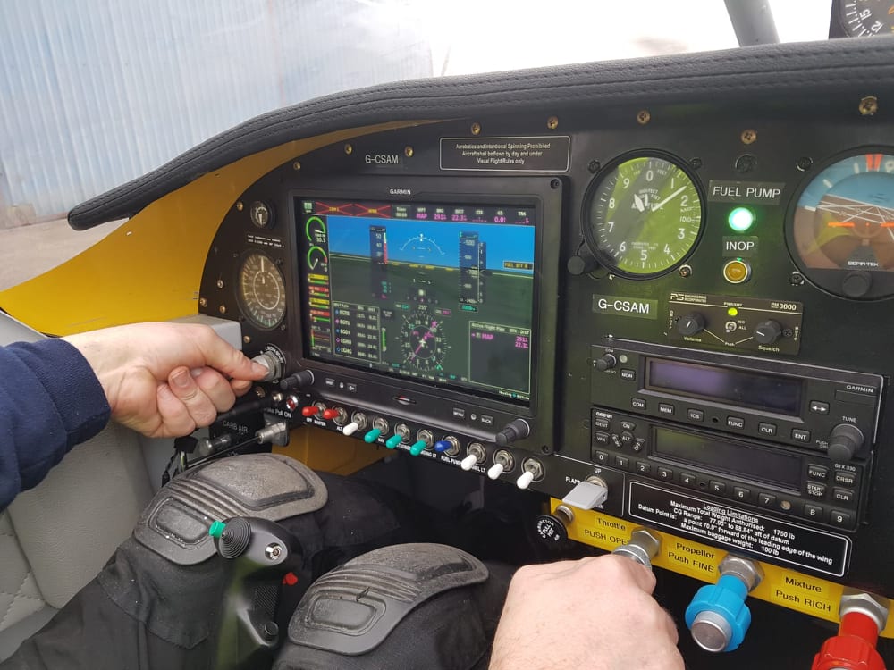
Originally, she had a single Garmin G3X EFIS (Electronic Flight Information System) – that big screen in the middle – and just a few of the traditional ‘clock’-style instruments on the panel: (left to right) airspeed indicator, altimeter, attitude indicator (aka the ‘artificial horizon’). The G3X handles just about everything, including the primary flight information such as airspeed, altitude, rate of climb and all the usual things, plus it has a built-in moving map display that runs on a GPS system, so that you’re never lost. The traditional gauges are there in case the G3X fails, which just never happens. Even in the event of an electrical failure, the G3X has an internal battery that will keep it going for several hours after mains failure.
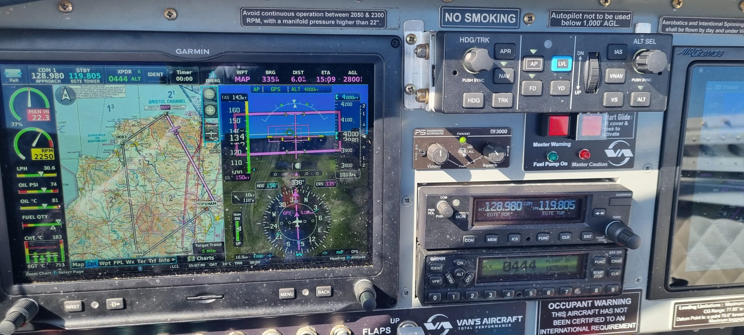
Later, we refitted the instrument panel with a new layout, with no dials at all – a completely ‘glass cockpit’ – and also added in an autopilot system. Here’s the new panel; the autopilot box is the one at top centre, just under the ‘SmartGlide’ button[12]. Despite the G3X allegedly never failing, we also have two additional independent self-powered electronic displays: the Garmin G5 (the little box to the left of the main display); and the Garmin 720 on the right, the one that looks like a Kindle Fire or iPad. Between them, these three displays give triple redundancy on flight information display systems, even in the event of a total electrical power failure.
Here is the panel in flight, with the moving map display on the main panel (the purple lines indicate the route programmed in for the autopilot) and the PFD – Primary Flight Display, which displays all the important information such as airspeed, altitude, heading and so on. The sunlight today, up here at 4,000ft, is pretty harsh and also at such an angle as to highlight all the dust on the panel. Sorry about that!
What’s she like to fly? Well, in short, she’s gorgeous. Powerful, fast and enthusiastic. Once you open the throttle on the runway this little aeroplane is positively eager to enter her natural element. Before you know it, only seconds from a standing start she’s at 65kt; the ‘rotate speed’ or Vr, and she’s leaping into the air and accelerating as she climbs. Quite astonishing really, far in excess of anything I’ve ever flown before. Whereas with the RS-180 G-VIZZ, we’d routinely use ten degrees of flap for takeoff, and retracting them in the climb-out, we initially used that procedure with Alpha-Mike but we found out that even though we had flaps deployed, with all the extra drag they give, still she rapidly accelerated in the climb to speeds in excess of the maximum flap extension speed, thereby risking breaking something! And so we now don’t use flap at all on takeoff, even on short fields. She’s just too sprightly to need it!
Control harmonisation – that’s another way of expressing the ‘feel’ of the aeroplane – is excellent, with rudder, elevator and ailerons all beautifully balanced and without any of them being more ‘dominant’ than the others. For example, in the Piper Warrior II, another aeroplane I love, the slab tailplane does give a different feel because it has such a large ‘pitch authority’; it doesn’t need much effort to make the nose go up or down. The ailerons on the Warrior, however, are not as decisive as that, so that althought the Warrior is still a great aeroplane to fly, it doesn’t have the same balanced ‘feel’ that the RV-9A has.
View from the cockpit is simply stunning. While the occupants are not sitting as high up as they would be in the RS-180, and the windowsills are not as low as they are in that aeroplane (actually no aeroplane I know has the same view as the RS-180!) even so the view is excellent because of the bubble canopy. There’s only the one frame breaking the otherwise uninterrupted view. Lovely!
Landing can be a little tricky because the nose undercarriage leg isn’t very strong. This means that even though there are many elements such as crosswind, windshear, sink rate, airspeed and all the other multiple factors that the Pilot has to consider in order to make for a good landing, the thing that must remain high on the list of priorities for the RV-9A Pilot is that the brunt of the landing must be taken by the main undercarriage; the bits under the wings. The nosewheel leg, in fact, is not even considered to be ‘landing gear’ as such; it’s more a ‘taxying gear’, only to be used when the aircraft’s speed has decayed enough after landing to allow the nosewheel to be lowered safely[13]. This involves using a lot of back-pressure on the control column after touchdown, to keep the weight off the nosewheel until it’s safe enough to lower it to the runway. And even then, when I land this aeroplane, I only lower the nose when I can’t stop it lowering itself, when there is insufficient airflow over the tail to keep the nose up any longer; the elevator has lost its ‘pitch authority’, if you like. Even then, I keep on a good back-pressure on the stick because it still helps keep the weight off the nose as the propeller wash[14] still gives a little bit of elevator authority even at taxying speeds. But as long as this is kept in mind, flying and landing this aeroplane is a breeze, and indeed a real delight.
Bembridge, Isle of Wight Flying Adventure
Probably the best way to describe this aircraft is to let you see her in action, so here is a photo diary of an epic flying adventure I had in April this year.
As a bit of background, let me explain that my son David is also a Pilot, and he flies from Kemble Airfield in Gloucestershire. He asked me if I would like to do a landaway meet-up on the Isle of Wight; specifically, at Bembridge Airport right on the eastern tip of the Isle. He intended to rent a club-owned Piper PA-28 Warrior II to be his chariot for the day, and so we arranged to meet at Bembridge Airport at about 1045 local time.
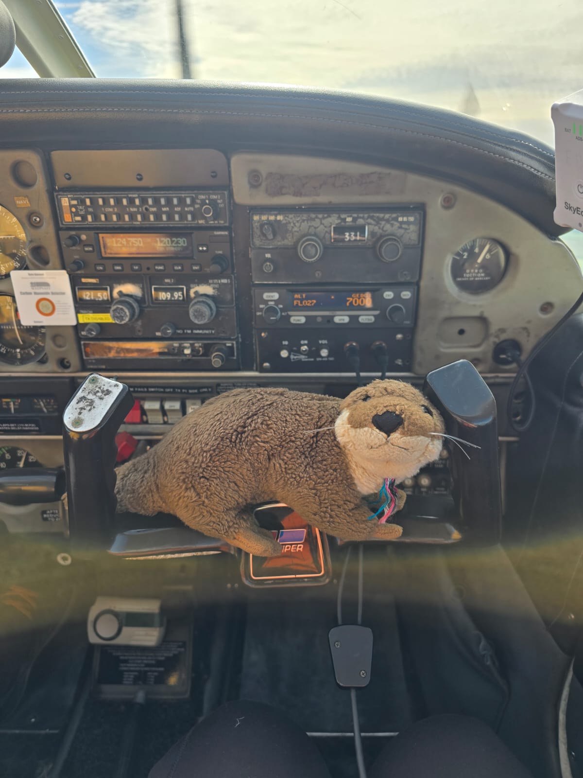
This trip was something I’d always wanted to do, ever since I had visited the Island back in 2015, back when Fiona was still alive, and with my daughter Ellie and some caravanning friends too. We had stayed on a campsite right next to the airfield, and so Bembridge has been on my landaway wish-list ever since then![15] So it was arranged that David, his wife Stace, and myself, plus Oscar – David’s toy otter mascot who loves to fly with him and goes on every flight with him – would indeed meet up at Bembridge and spend the day together on the Island.
So, I booked the aeroplane and checked the weather forecast for the upcoming weekend – this was on the Monday before the Saturday on which we flew out. Looks good on the long range forecast but of course that can all go to trash on the day. Did the PPR request – that’s ‘Prior Permission Required’ – basically an online form you fill in to let them know to expect you. It’s important so that they can account for your aircraft as part of the day’s traffic pattern, but also for safety reasons; if you don’t arrive something like when you say you will, they will have emergency search and rescue procedures that they will implement so that they can come and try to find where you’ve pranged the kite[16]. Planned my navigation route – headings, heights, speeds, landmarks, turning points. Danger areas like military ranges. Checked the NOTAMs – the Notices for Airmen; telling you about important things en route that may affect the way in which you conduct the flight. Things like high obstructions (cranes and stuff) near airfields, temporary airspace restrictions, temporary danger areas maybe because of high-energy military flying exercises (meaning fast-jets doing practice dogfights), temporary airspace restrictions for things like airshows or displays by the Red Arrows, or maybe even ballooning events. Looked up radio frequencies and generated a communications plan. Considered diversion airfields to be used in emergencies. Checked with Nigel to make sure the aeroplane was serviceable. Briefed about the fuel state and what he wanted me to do with the aircraft on my return – like did he want her refuelling ready for him the next flying day, that sort of thing. Comprehensive preflight planning is key to any successful cross-country flight, especially where that will involve a landaway and/or liaison with multiple ATSUs (Air Traffic Service Units, so people like radar services, control towers, approach services and all that sort of thing. Complying therefore with the annoyingly (and deliberately) alliterative Pilot saying, ‘Proper Planning Prevents Piss-Poor Performance’, which nevertheless highlights how important the planning stage is to the satisfactory execution of the day’s flights. Most people who don’t themselves fly also don’t realise how much planning goes in to a cross-country flight, especially one involving a landaway, and even more so on one involving flight over the sea, which this one did of course. I’m flying to an island, remember! Also, making sure I have the most up-to-date aeronautical chart; checking that my equipment is in good order (like my headset, for instance) and that I have all my pens and flying gloves and baseball cap and sunglasses and all the other bits I need.
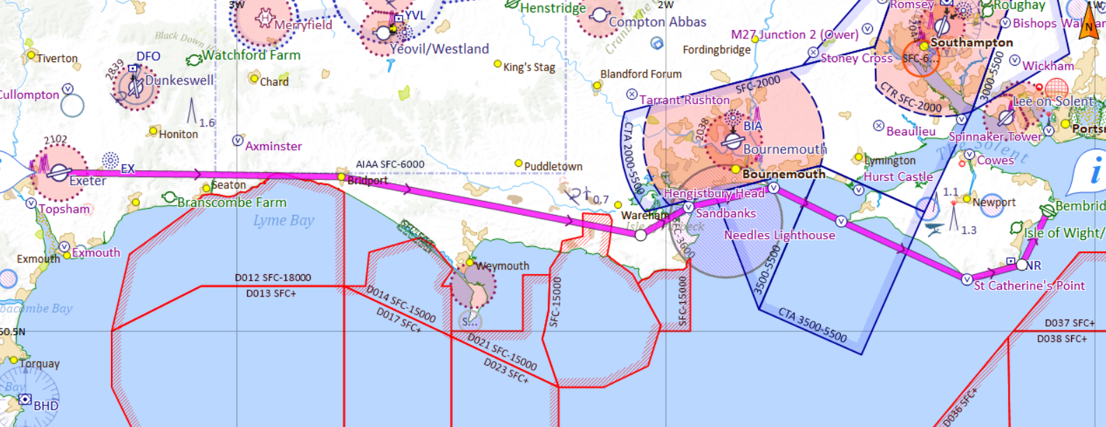
Here’s the SkyDemon chart for the route, with the intended track indicated by that thick magenta line. SkyDemon is a brilliant piece of software that aids greatly in the flight planning stage, bringing together all the information that the Pilot needs for the route. Some Pilots I know use it on their phones and it acts as a kind of satnav, a bit like the Garmin G3X system in Alpha-Mike.
Well, the Saturday dawned bright and relatively clear, so, armed with the current met forecast (the weather) and what we call the ‘Actual’ (what the weather is like right now at the relevant airfields including diversions, and their TAFs: Terminal Aerodrome Forecasts; what the weather forecasts are for the airfields in question), off we trot for Exeter Airport.
Alpha-Mike lives in a hangar on the secure and non-passenger-related north side of the airfield, so I need a special (and expensive!) ‘Northside Pass’ to get in, and so I make sure that this is also in my bag before setting off.
Arriving at Exeter, I dragged the aeroplane out of the hangar and did my preflight walk-round inspection, where I look for potential problems on the aircraft, check the oil and fuel levels, make sure the windscreen is clean, and all the other minutiae that make for safe flying. Better to find a fault on the ground rather than have that problem announce itself up in the air! Once done, and once I’d refuelled the aircraft, it’s time to book out – that’s where I tell the Exeter Air Traffic people where I’m going and when I think I’ll be back; a bit like the PPR mentioned above and for the same reasons – and in we get. I had donned a lifejacket and PLB because I’m going to be flying over the sea. It’s only for six miles or so, but there’s a reason why it’s called a lifejacket! And the PLB is a Personal Locator Beacon; a radio device that you activate once you’re down in the drink[17] and floating hopefully the right way up, so that Air-Sea Rescue can find you.
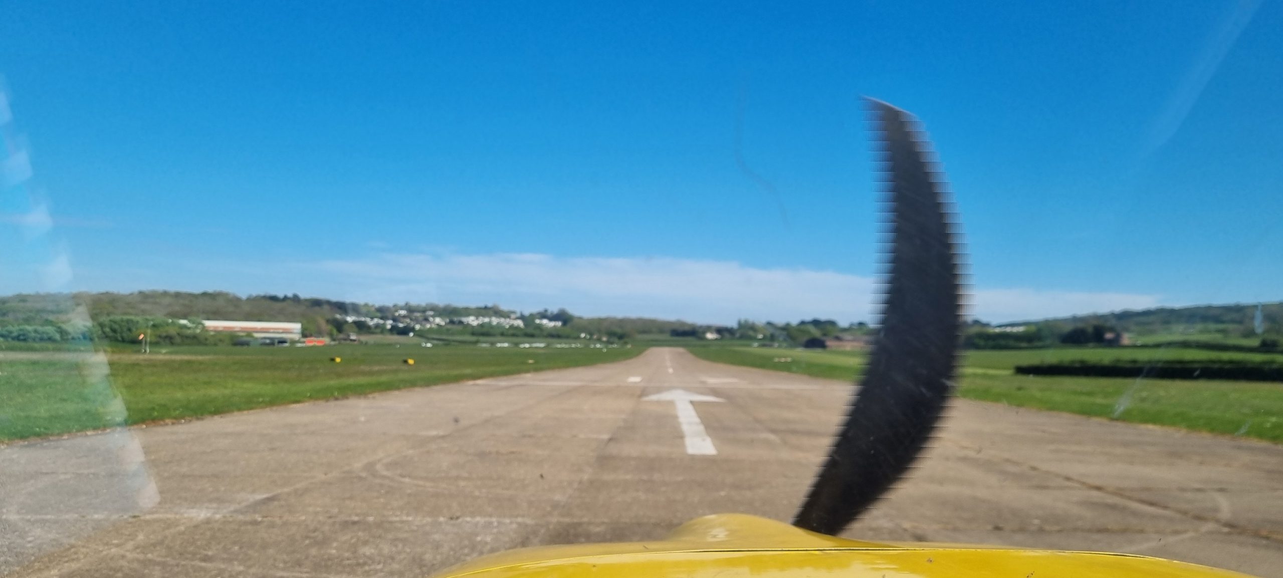
Ok, so start her up, program the navigation computer and autopilot, perform the power checks and pre-take-off vital actions from the checklist, and then call for taxi clearance. Lined up on Runway 08 at Exeter and cleared for take-off, the view gave me the usual (but somehow always new) thrill of anticipation of adventure[18].
There is no finer view in all of aviation; I am going flying, right now, and I am going to interface with – and indeed become a part of – this singularly unique, finely-tuned and indeed beautiful piece of machinery called a Van’s RV-9A. And today she’s going to carry me nearly 100 nautical miles, in under an hour, to meet family for a lovely day out. What can be finer than that?
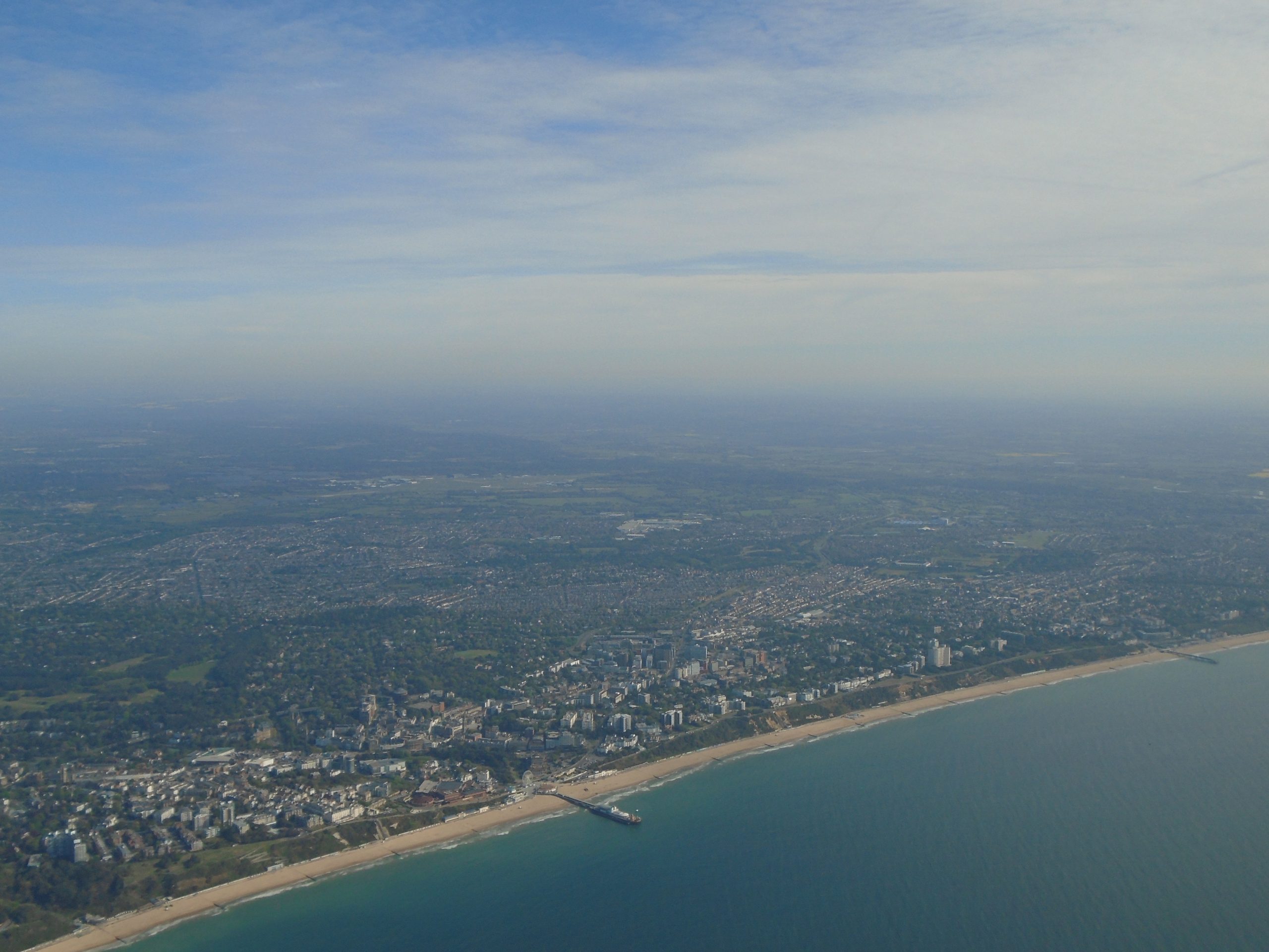
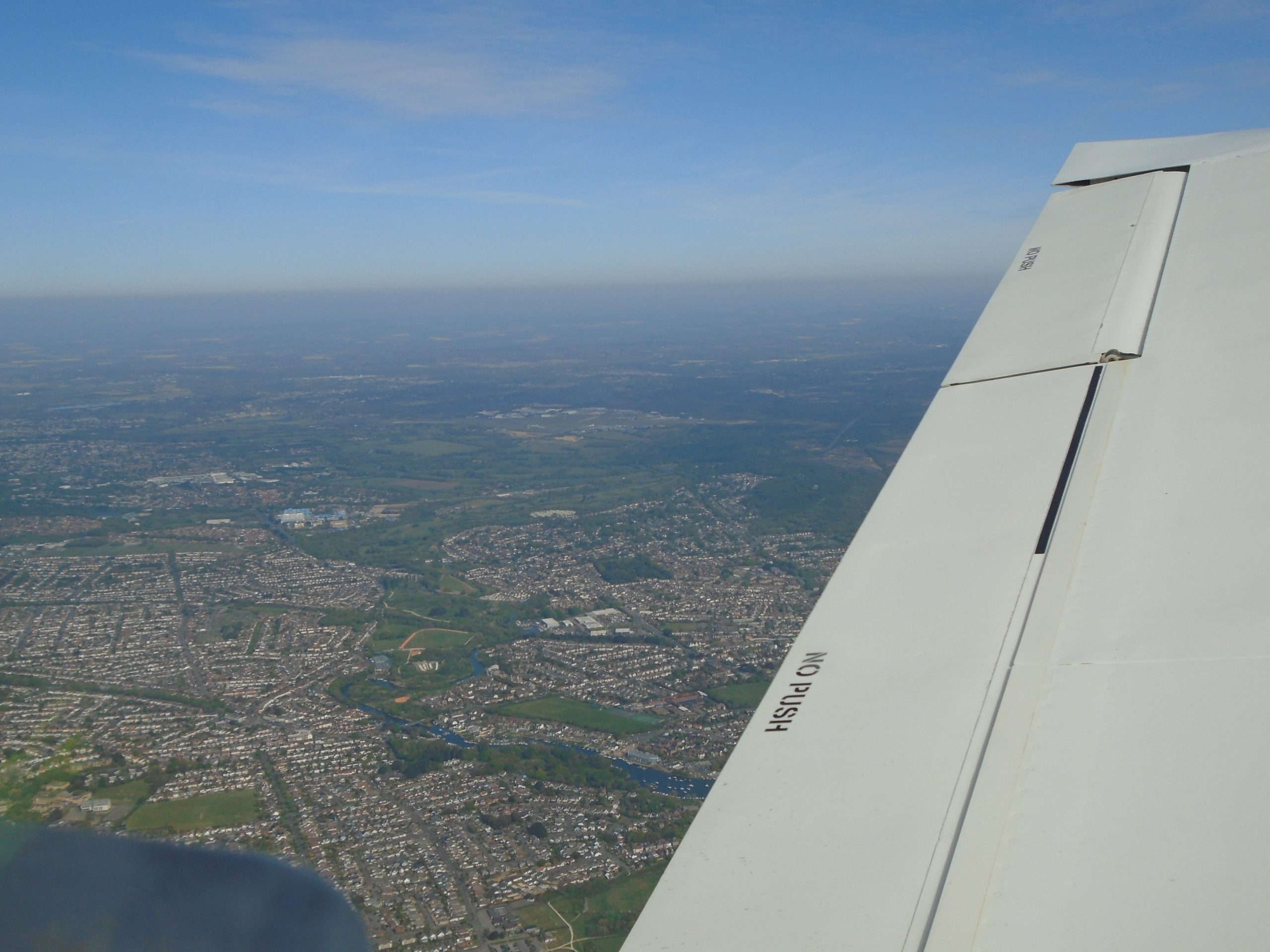
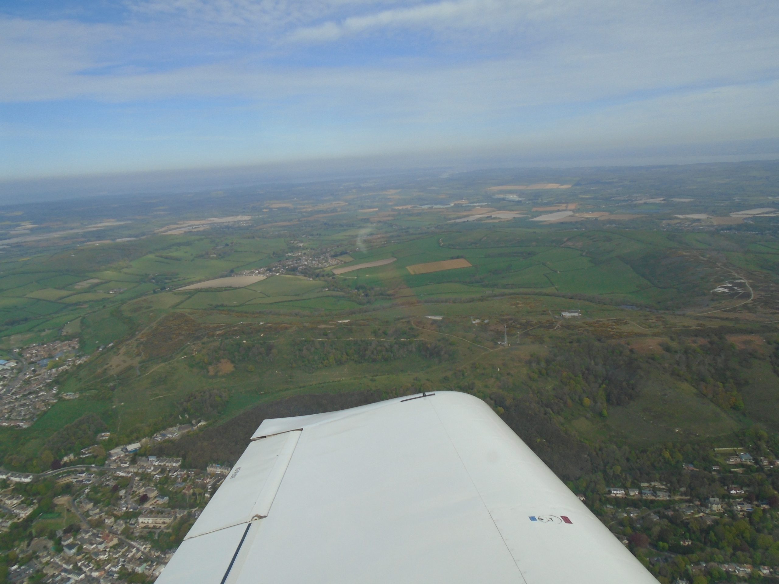
As always, take-off and climb-out are busy times so there’s neither time nor mental space for photography. But once established at the correct altitude, and in the cruise with the autopilot engaged, I am now hands-free for photography, as well as being eyes-free to keep a good lookout[19]. So here’s the first shot, of the Devon town of Honiton about four miles off my port beam (it’s visible just above the wingtip):
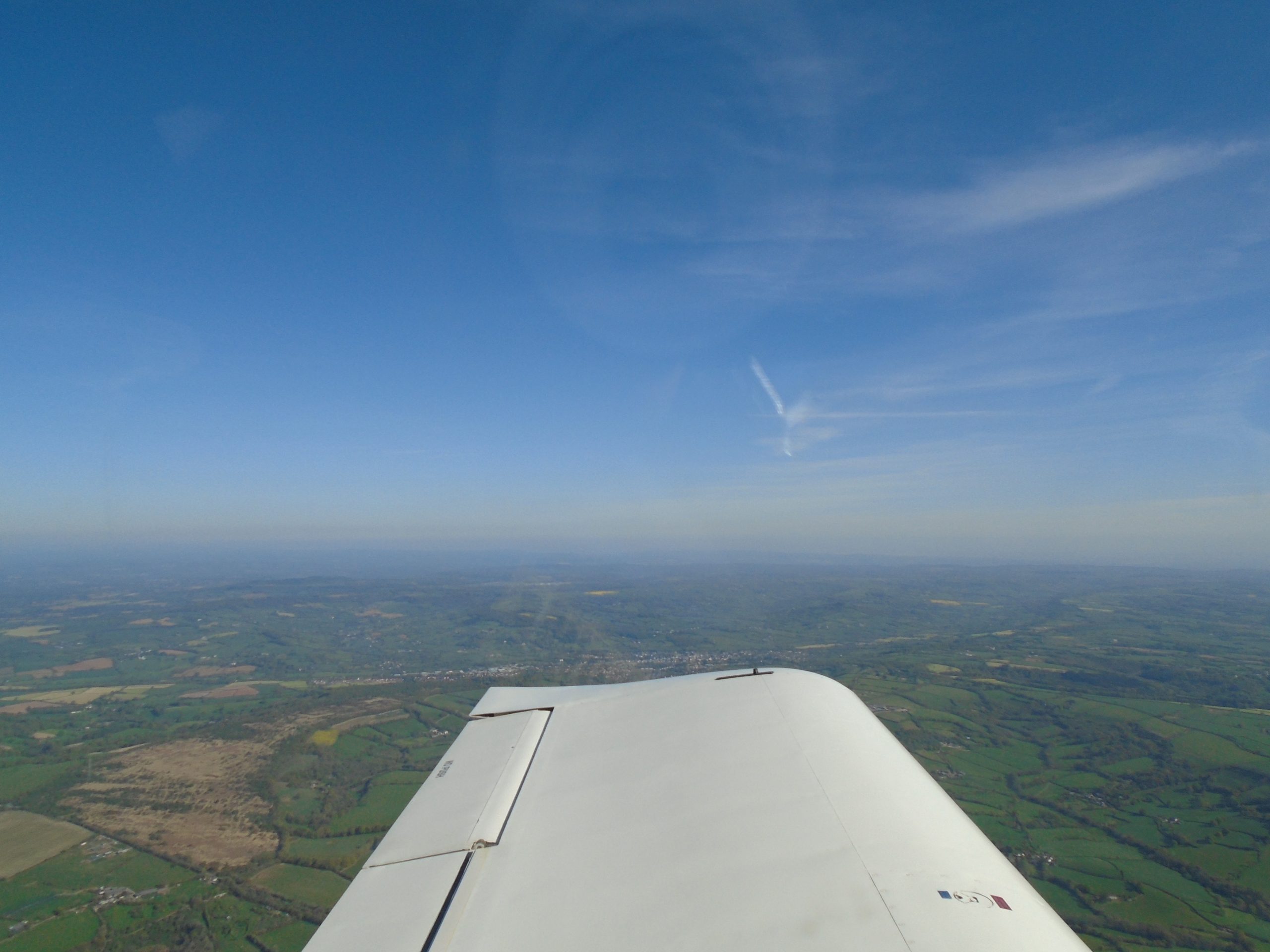
This is the Garmin G3X showing the PFD in full-screen mode, with the aircraft position shown on the mini-map inset on the bottom right. You can see that we are just a mile north of Seaton, East Devon[20].
Axminster, East Devon, just forward of the wing

The view forward from 3,000ft, with Lyme Regis at the bottom of the photo, and with Chesil Beach and Portland Bill just visible. It’s quite hazy up here this morning. But it’s still utterly, utterly glorious.
Coming up on Dorchester:
Portland Bill and Weymouth Harbour just visible in the murk. Actually, visibility today is excellent for aviation, just not so much for long-view photography.
Coming up on Poole Harbour, Dorset
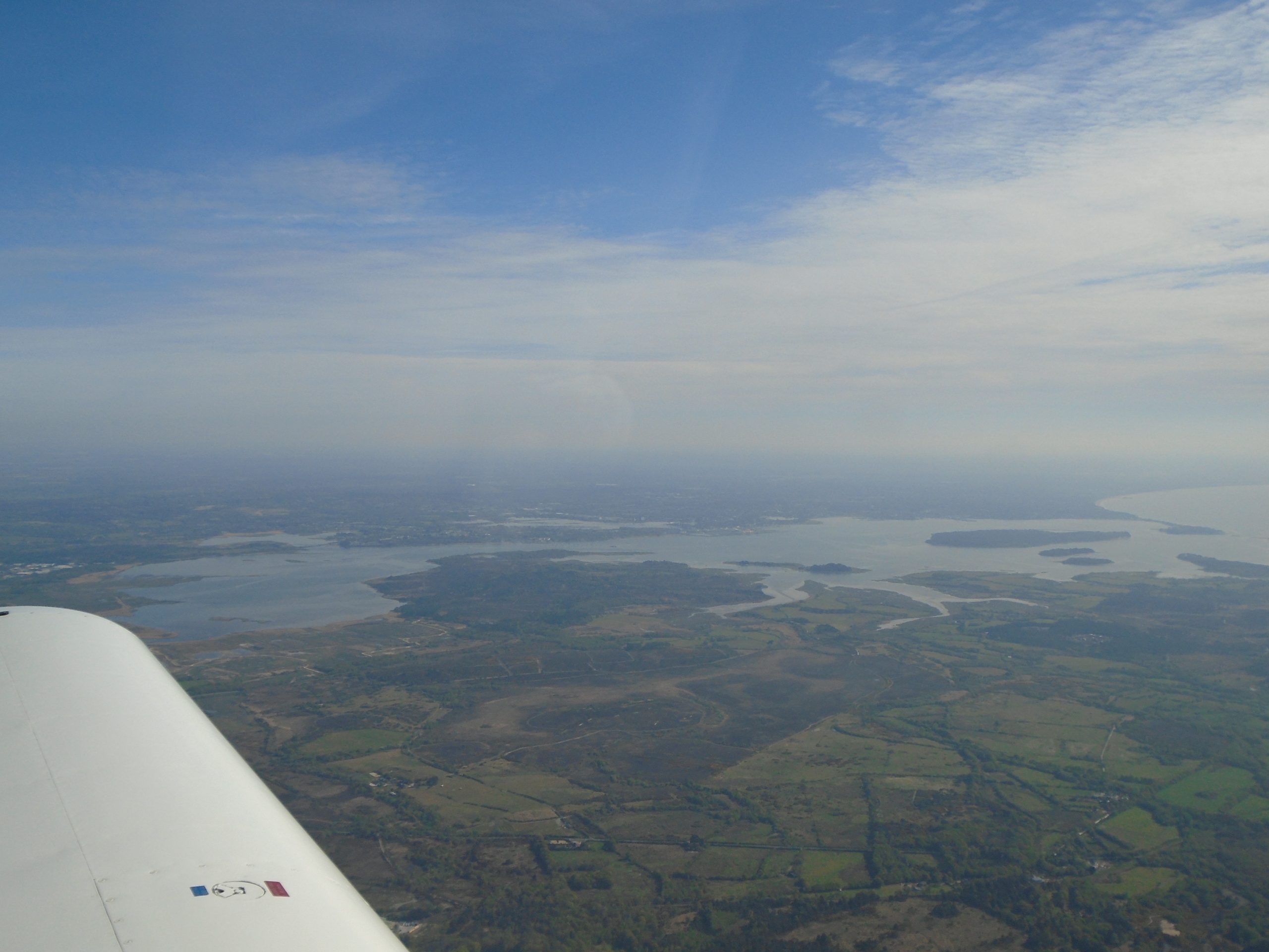
Brownsea Island, Poole Harbour. This island was the inspiration for the fictional ‘Whispering Island’ in Enid Blyton‘s ‘Famous Five’ book, ‘Five Have A Mystery To Solve‘.
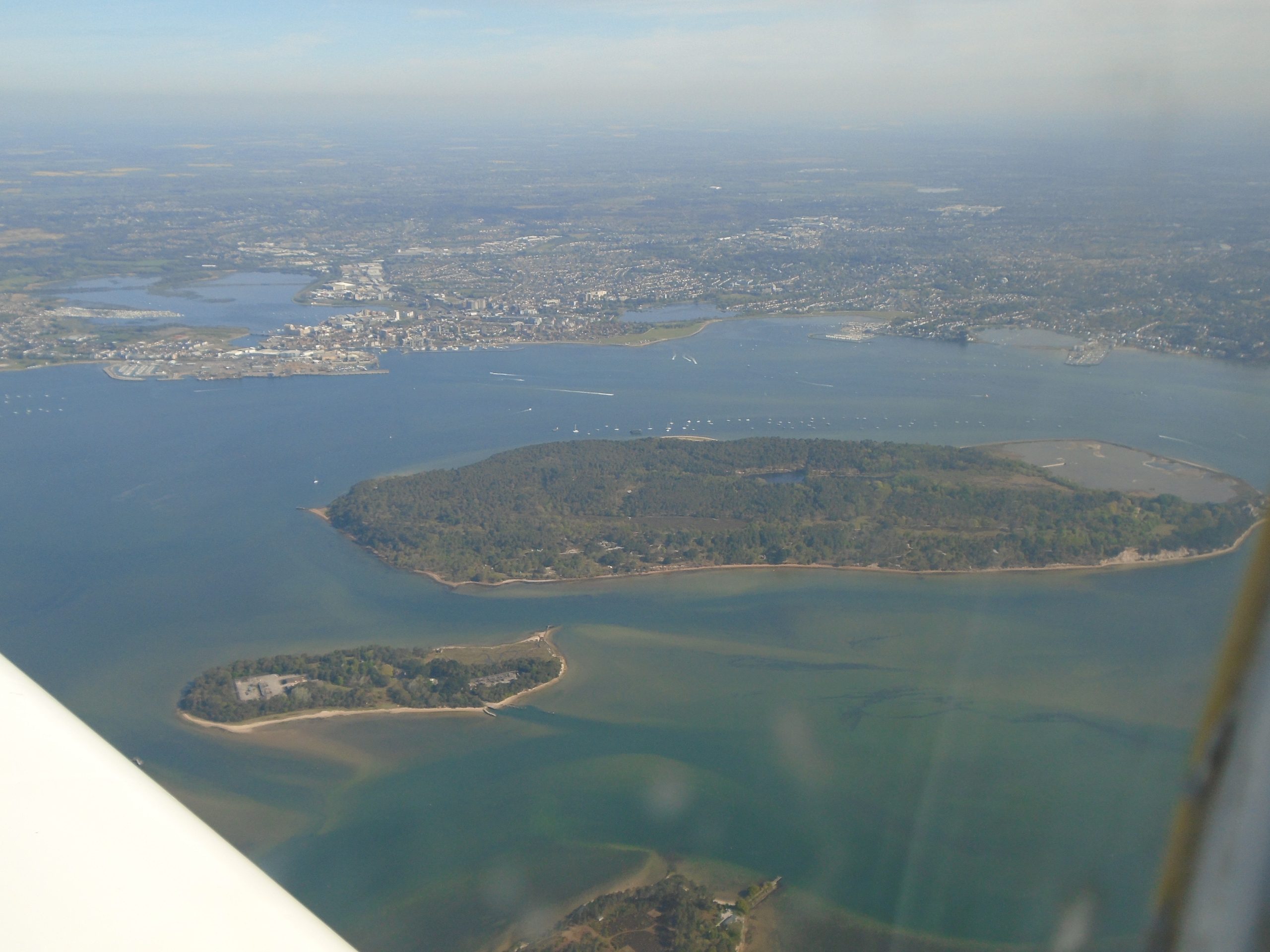
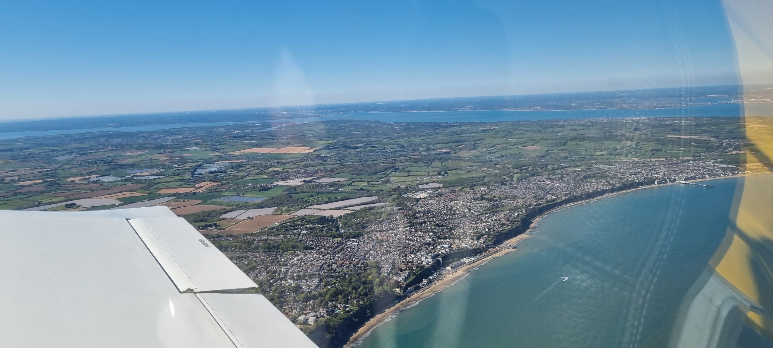
Bournemouth coming up. I’m now what we call ‘feet wet’ (flying over the sea), but I also happen to be within easy gliding distance of the land should the hamster die[21].
See what I mean about the superb view from this aeroplane?
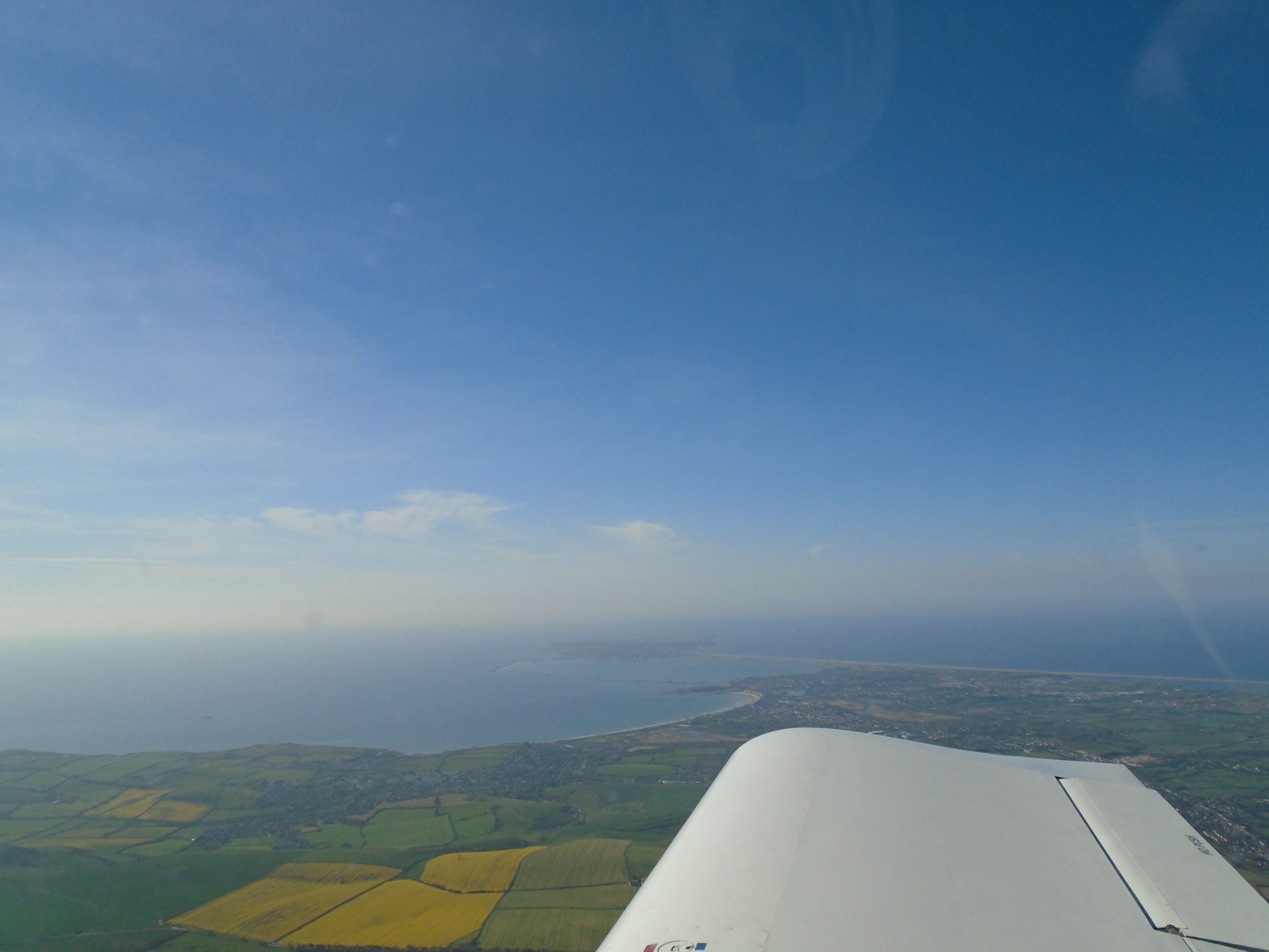
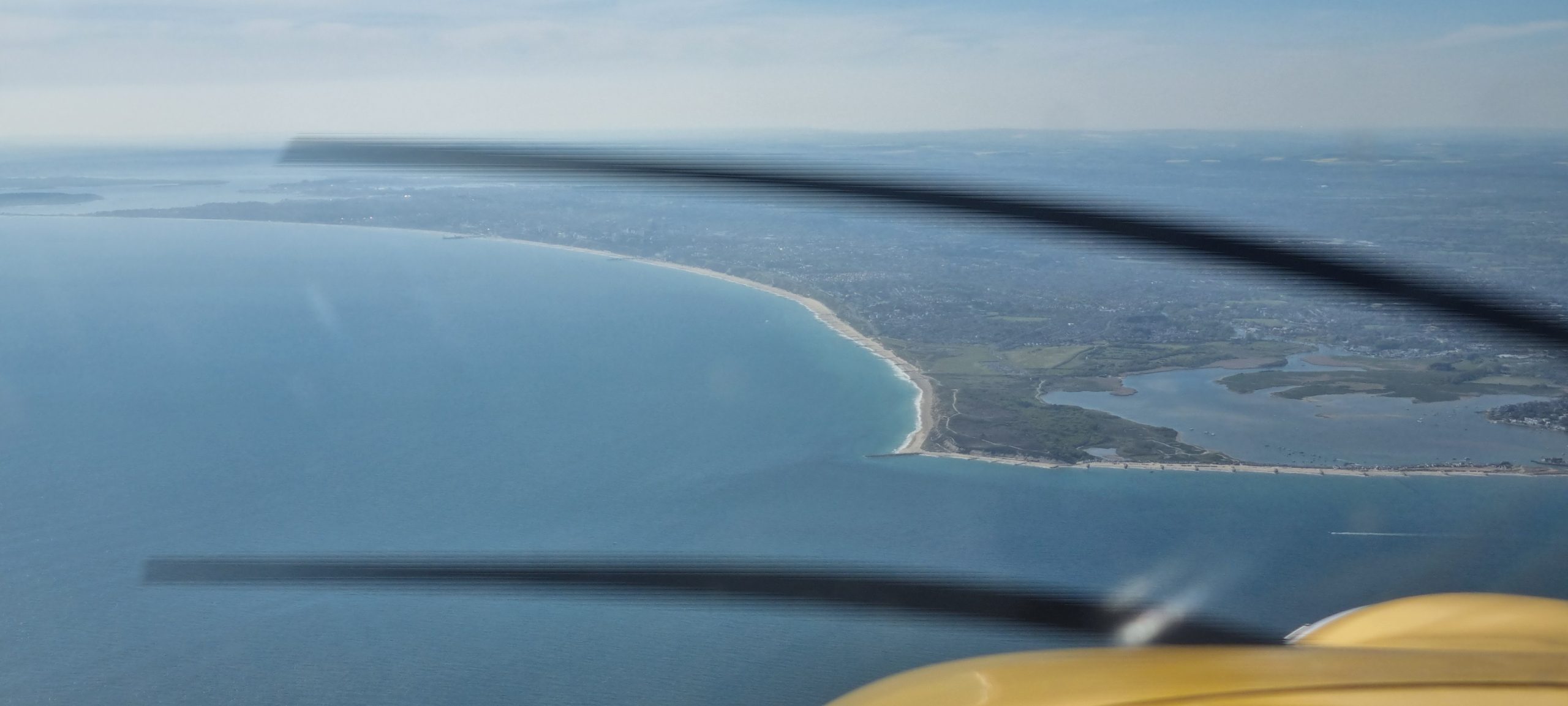
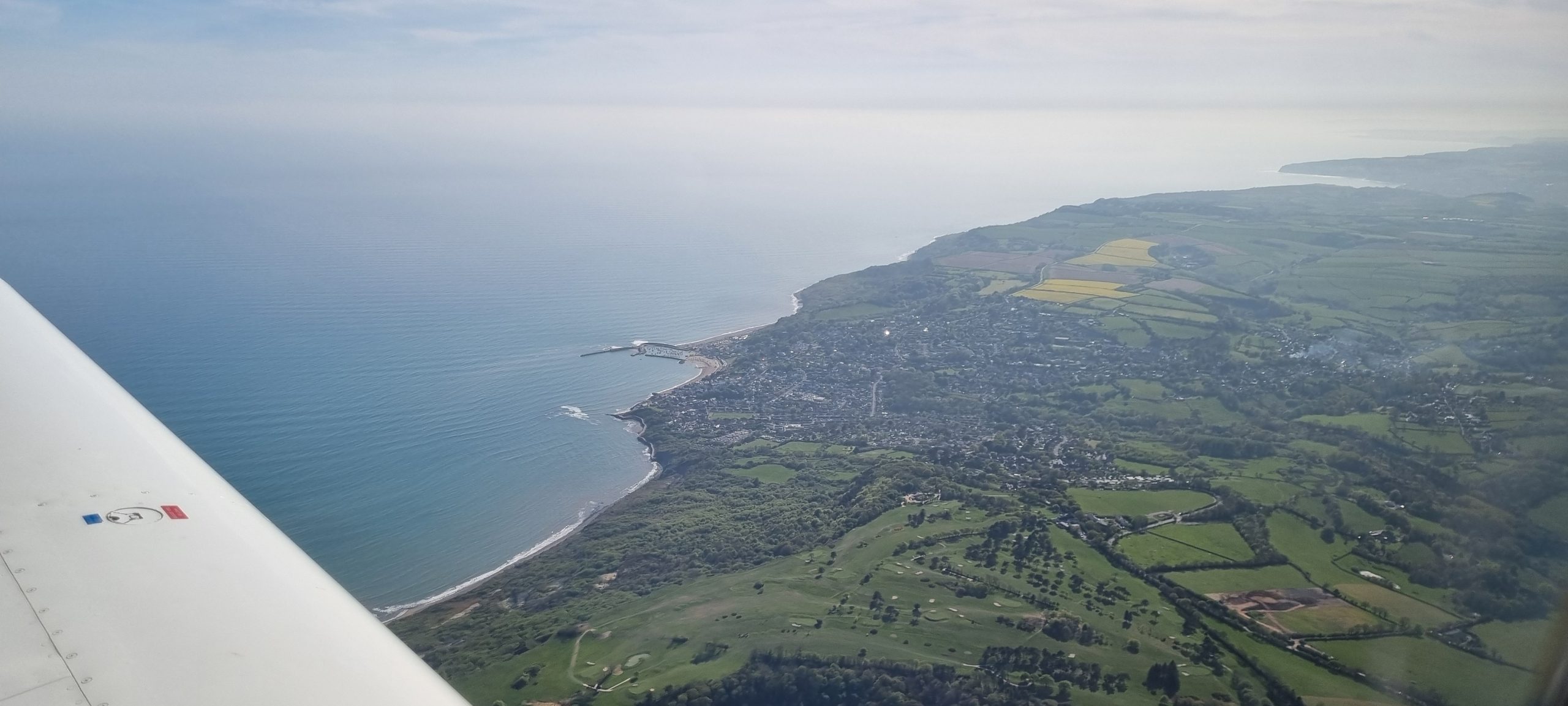
Approaching Hengistbury Head, Dorset, the turning point which will set me up on my new heading over the sea, heading out to the Isle of Wight.
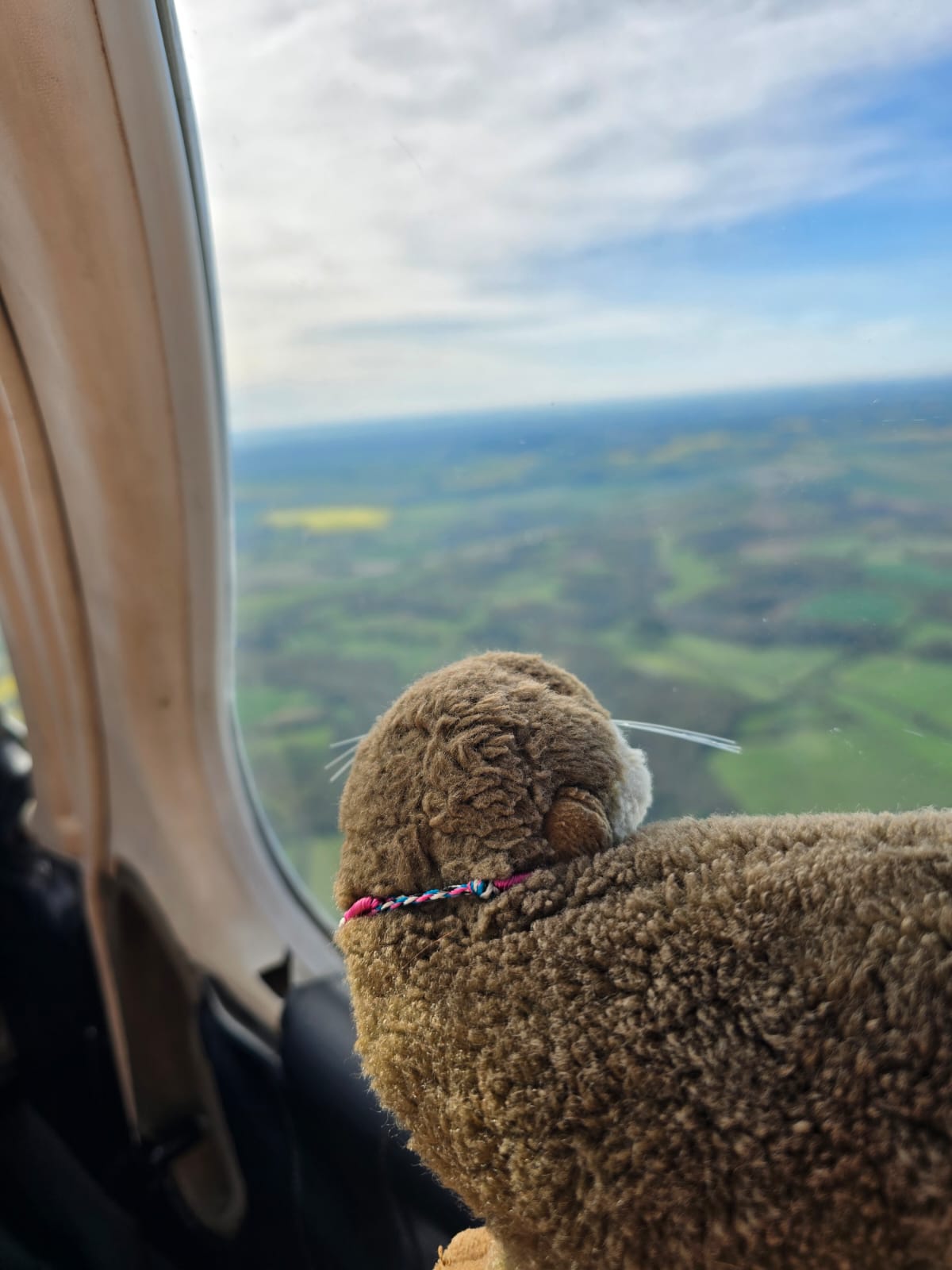
At the same time, Oscar the Otter (whom I mentioned earlier) is at the controls of David’s Warrior aeroplane, most likely somewhere over Hampshire.
…while my autopilot system executes the coasting-out turn over Hengistbury Head for me. The town visible aft of the wing, there, is Southbourne, Dorset.
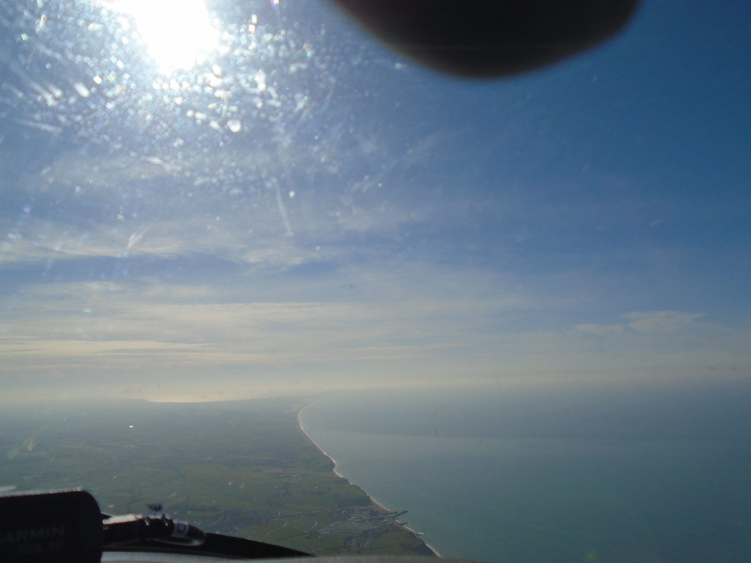
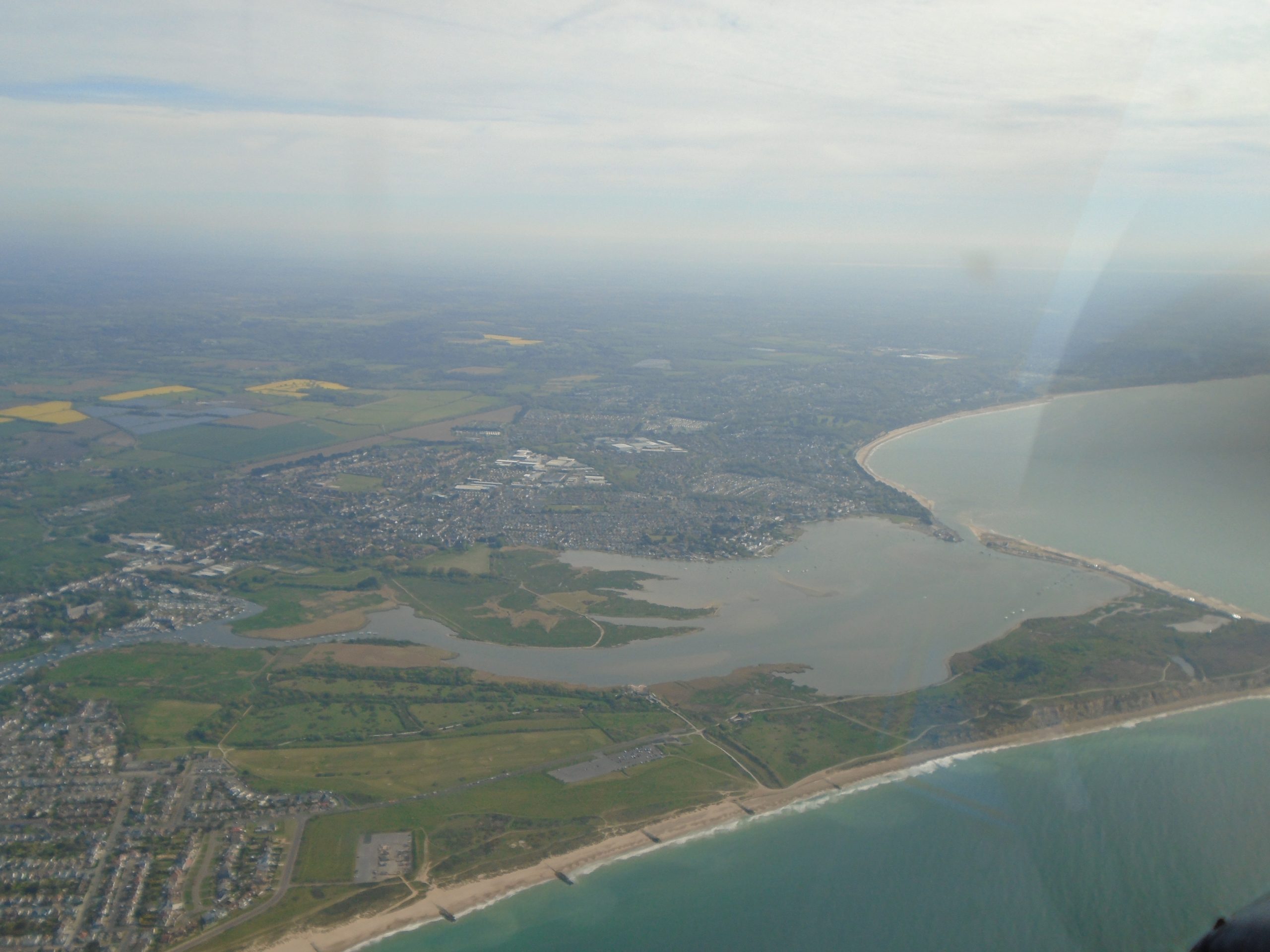
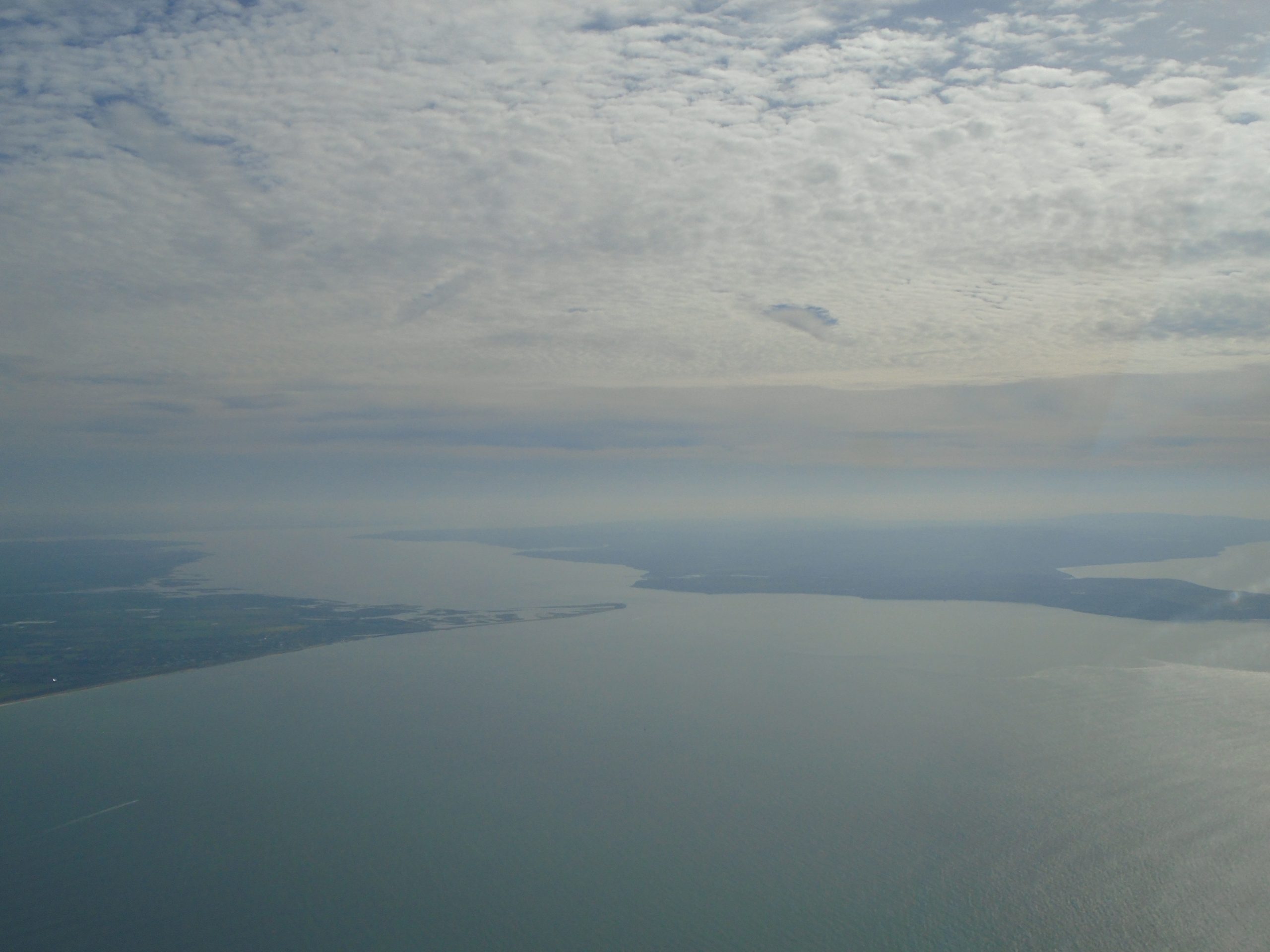
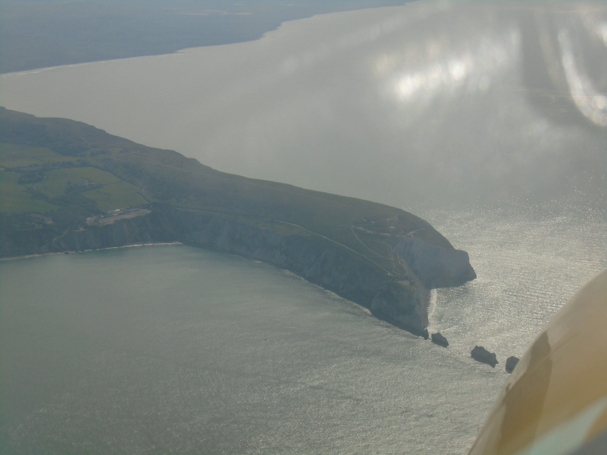
The view down the Solent through the murk, from just past Hengistbury Head. This is because it’s early morning; this will all burn off later in the day. The entire Isle of Wight lies to the right of picture.
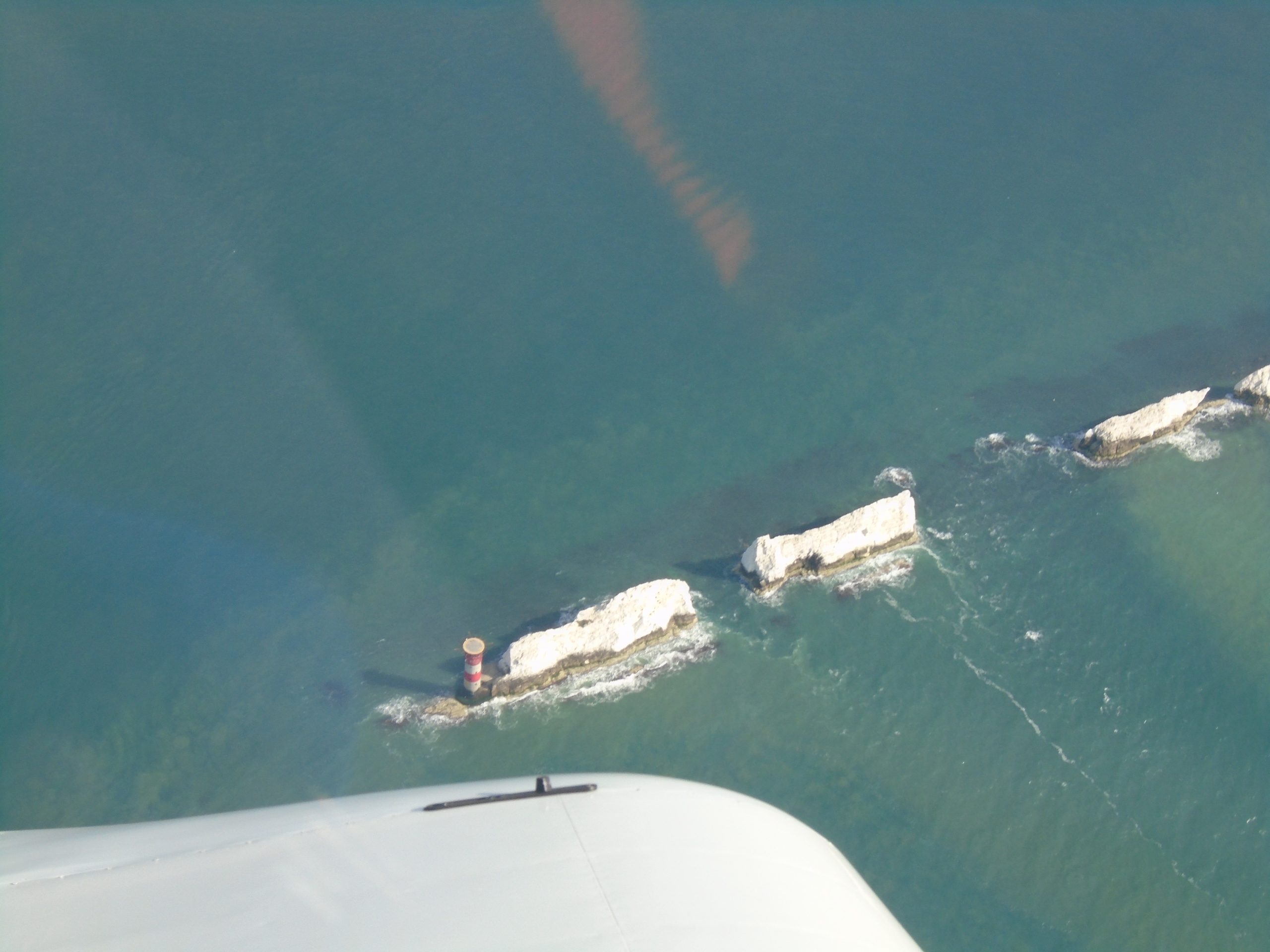
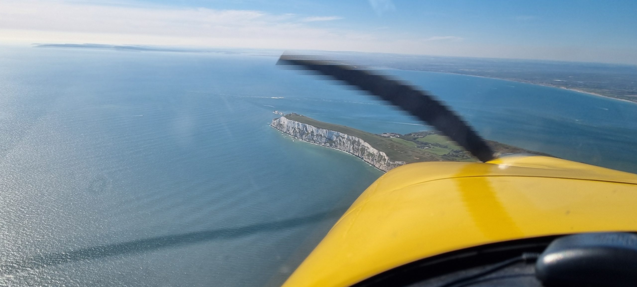
The Needles, IoW
Taking over control from the autopilot for a few seconds, I racked the aeroplane into a fairly steep left bank so as to get this lovely shot of the Needles with their Lighthouse:
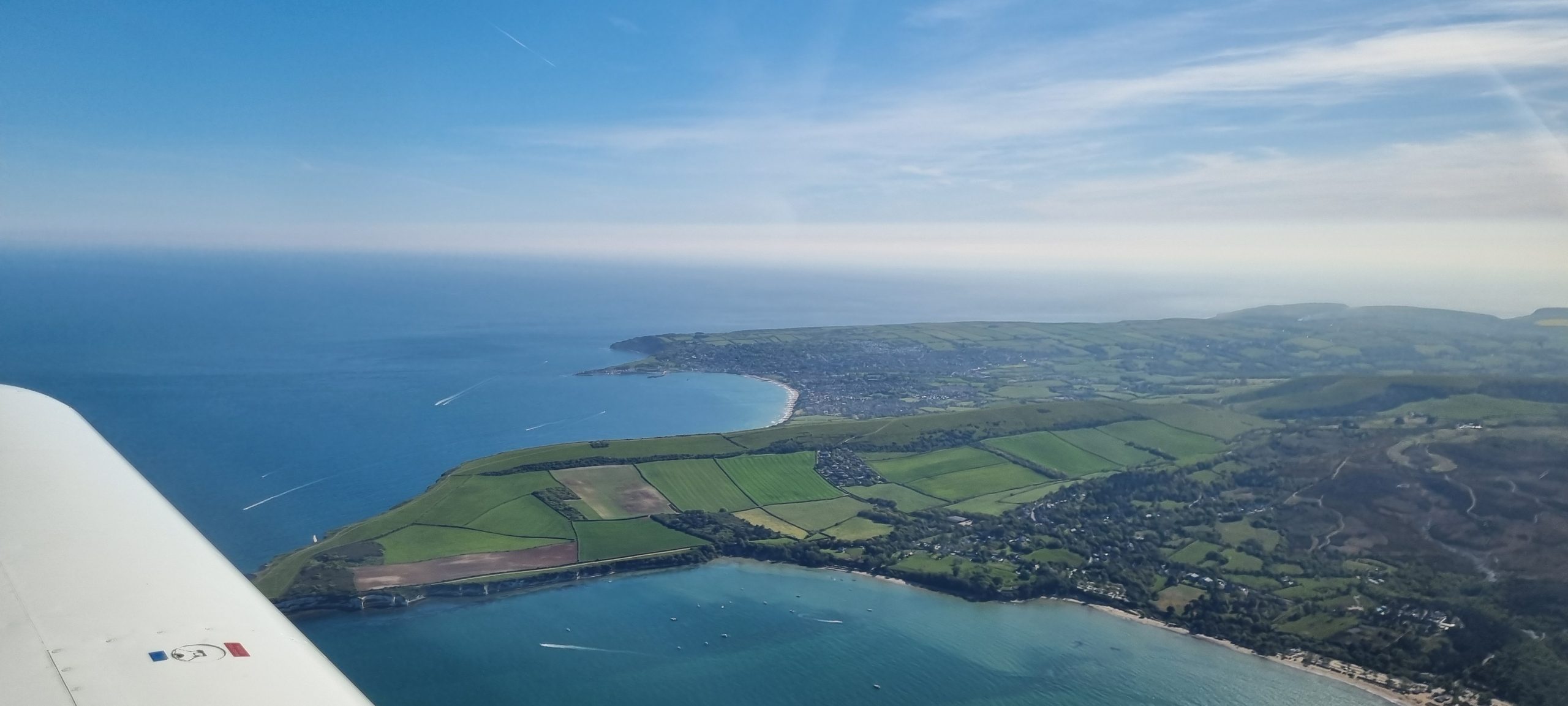
Now transitioning to manual control for a lovely sightseeing tour of the south coast of the Isle, I could still use the autopilot temporarily to hold the aircraft straight and level in order for me to take photos as required. This is Ventnor Downs, the steep hill above Ventnor. There are the remains of a WWII Chain Home radar station up there, which was attacked by German dive-bombers at the start of the Battle of Britain in 1940. I visited the site back in 2015, and there’s still a lot of interesting military archaeology up there. For a World War II geek like me, anyway…. 😉
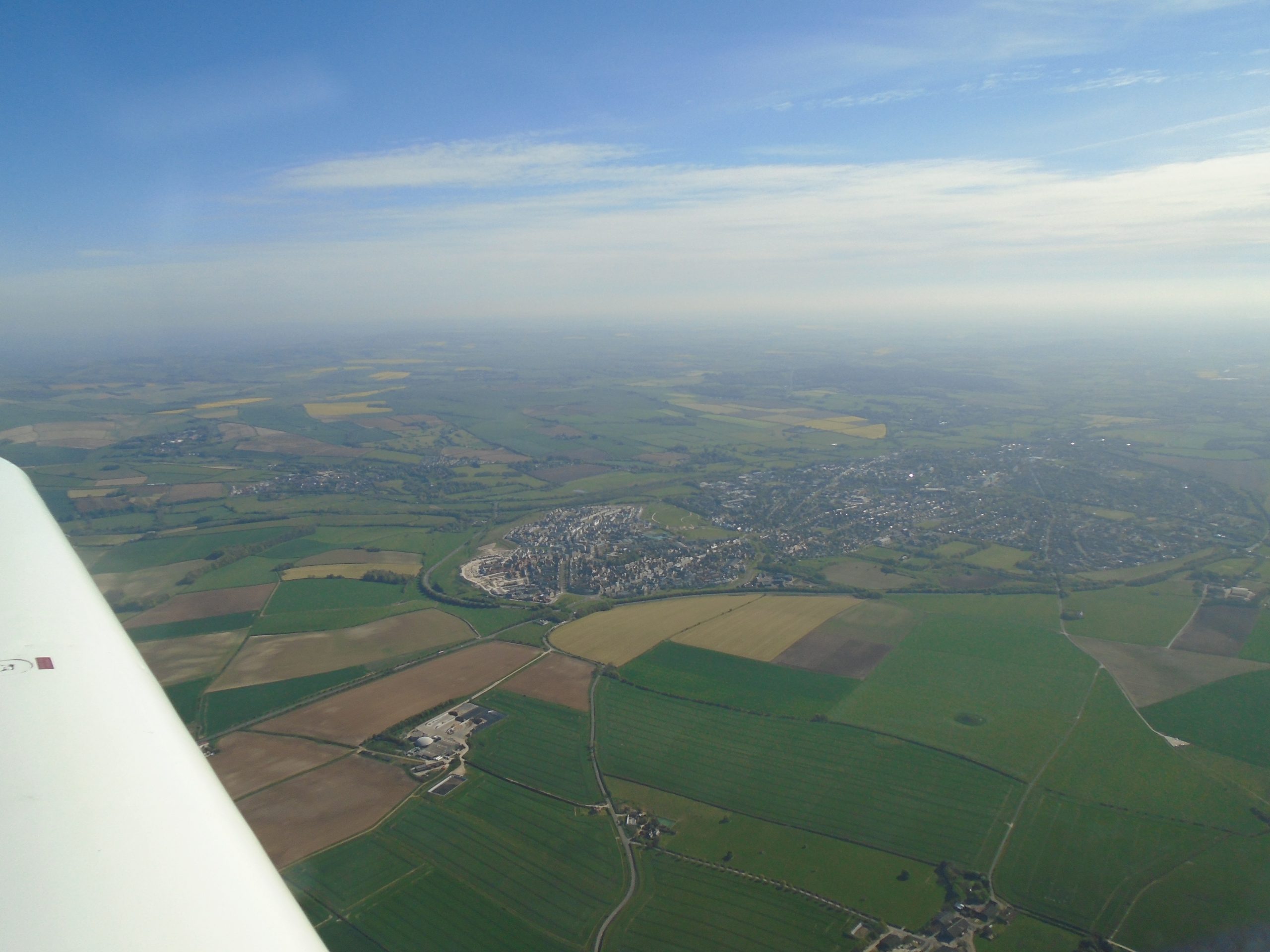
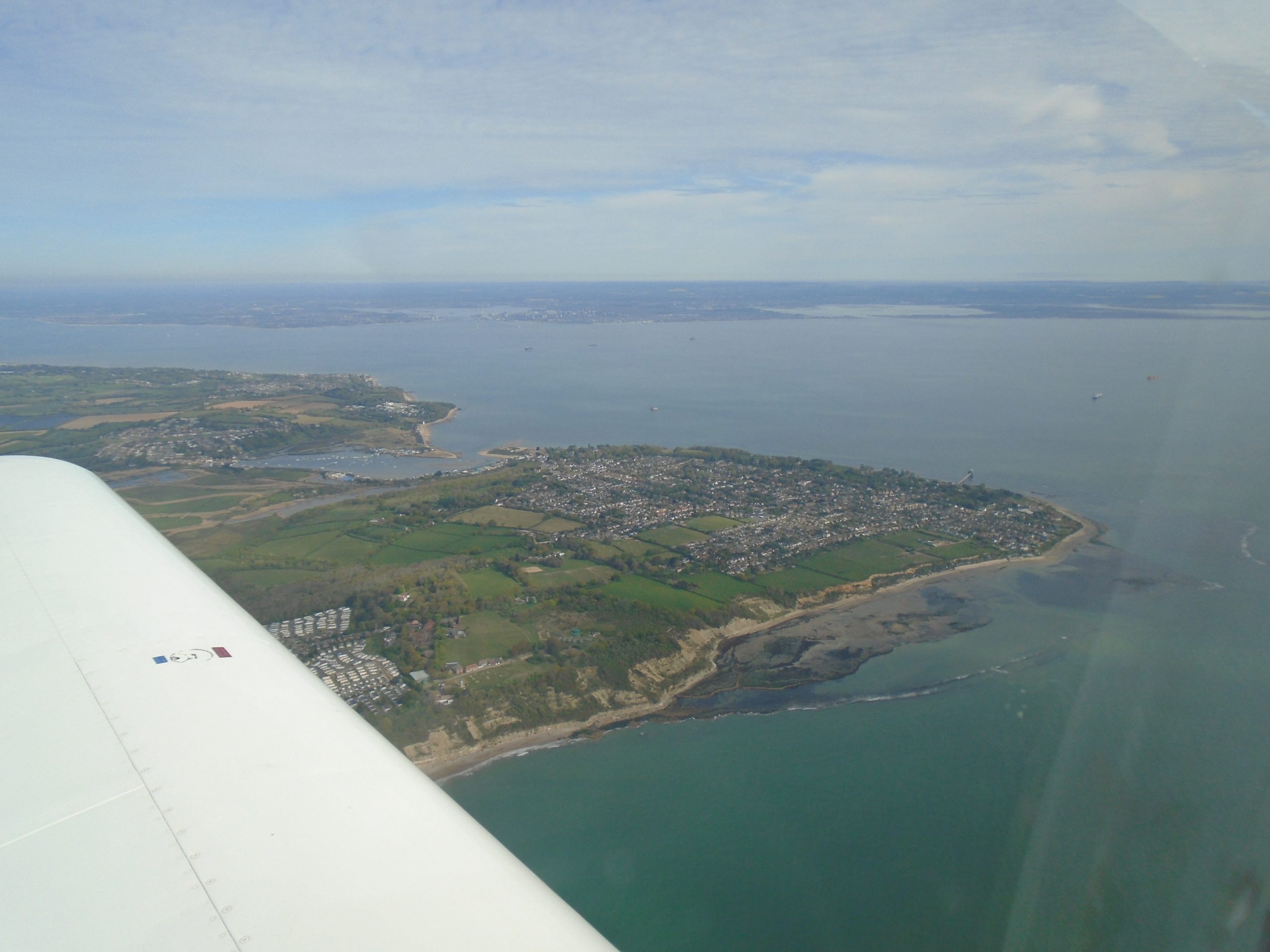
And now, coming up on Bembridge, the town on the Eastern tip of the Isle of Wight. The Solent, Porstsmouth and Hayling Island visible in the distance.
Meanwhile, having relinquished control back to David, Oscar is now enjoying the view of the Hampshire countryside out of the passenger side window of the Warrior.
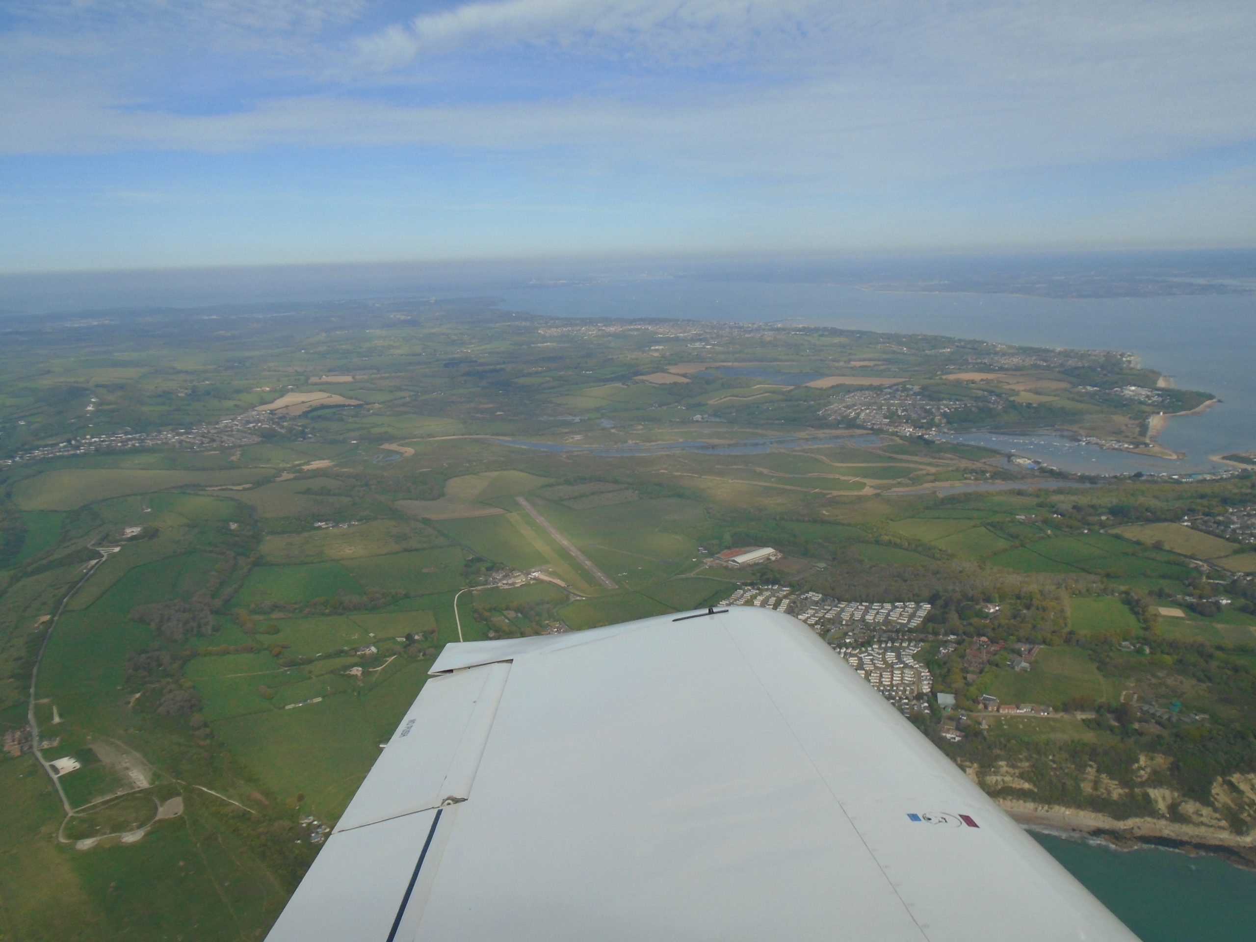
…while I have my target in sight! Bembridge Airfield’s main runway 30/12, just above the wingtip as I roll in to a sort-of ‘crosswind’ leg to set up the circuit. Runway in use today is Rwy 12 which runs in a south-easterly direction, so I’m looking up the opposite direction in this picture. I need to set up so that I will be landing in the direction that, at the moment, is towards the camera. Things get a bit busy from now on, positioning the aircraft, so as to join the circuit while at the same time avoiding annoying the neighbours by overflying their greenhouses, that sort of thing.
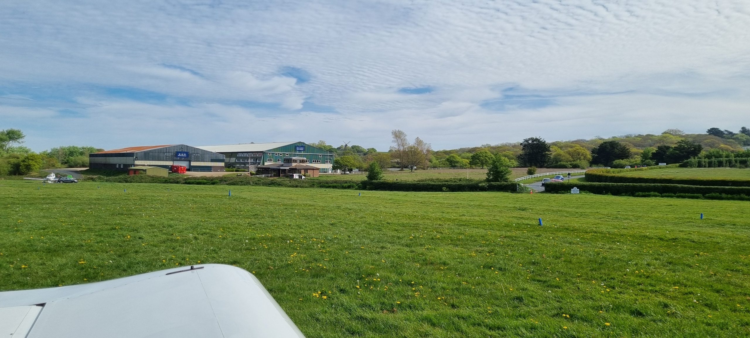
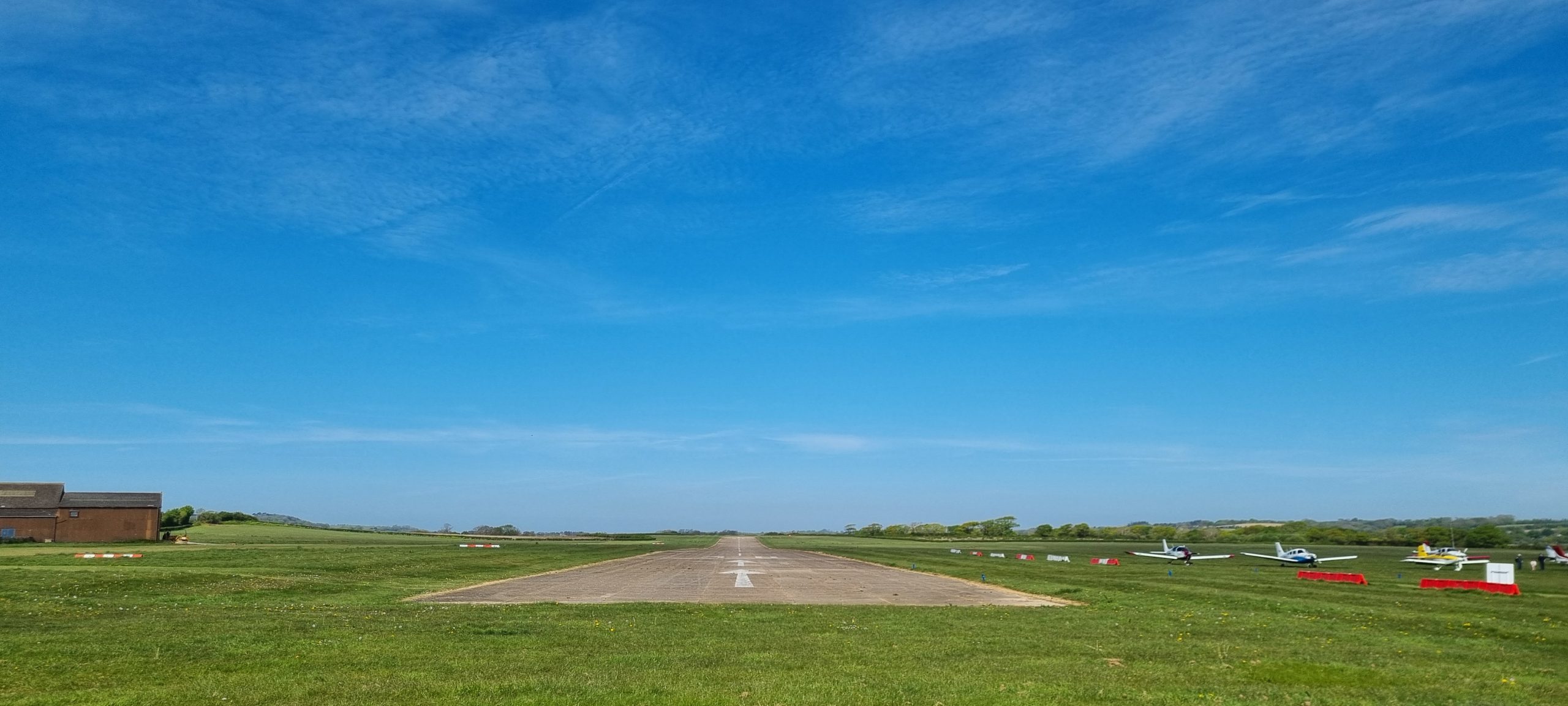
Aaaand safely on the ground at Bembridge Airport. Runway is concrete but the parking is on grass, so as I mentioned above, I have been really careful to keep the weight off the nosewheel while taxying on the uneven grass surface. Now I’m parked up and looking across to the Britten-Norman aircraft factory to the north east of the airfield.
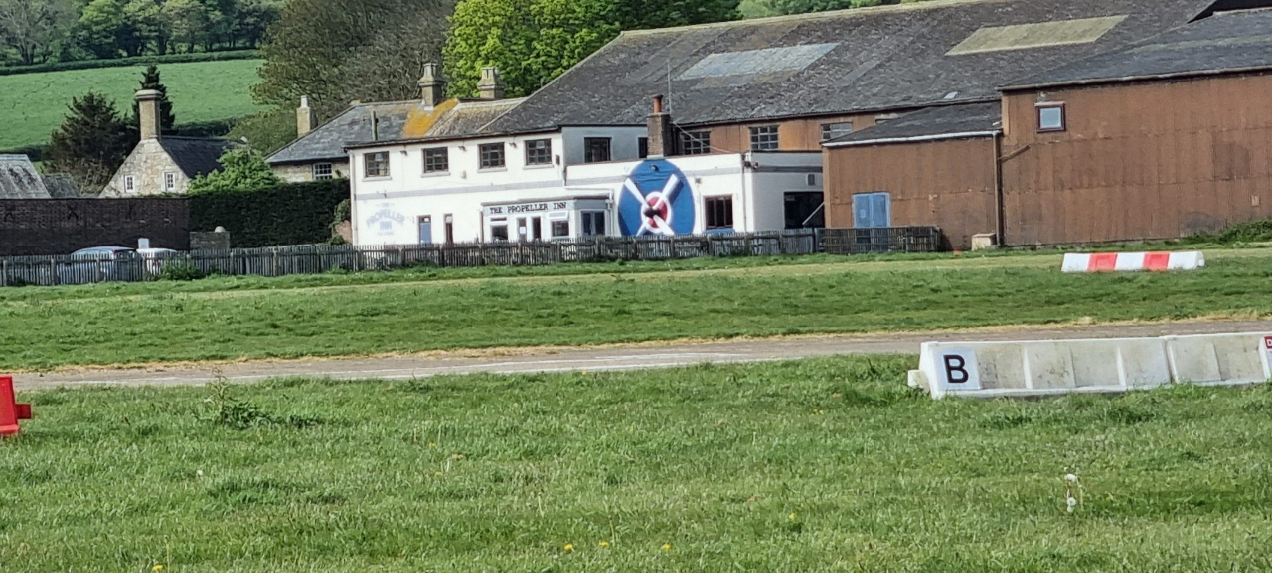
This is the Propeller Inn, Bembridge. I spent many a happy hour there in 2015 with Fiona and our friends on our camping holiday. More on the Inn later!
G-CSAM parked up at Bembridge. I was the first arrival of the day; it got a bit busy later on!The Cirrus aircraft with the red tail, parked beyond Alpha-Mike, is a Canadian-registered one. A local asked me if it was my aeroplane because I was wearing a Canada baseball cap… well I need something to keep the sun out of my eyes when up in the sky, and my brother (who lives in Canada) had sent me it a number of years ago, so I use that. You’ll see it in a later picture.

On the way to check in at Air Traffic Control, thought I’d bag this lovely view straight down Runway 30; the footpath passes directly across the extended centreline.
Back on the airfield after paying my very reasonable £15 landing fee, I got this nice shot of Alpha-Mike on the deck with her flaps down. What always gives me a really strange feeling during a landaway is that I look across the airfield at the parked aeroplanes, single out ‘my’ aeroplane, and think like ‘Crumbs, I came here in that, and that’s how I’m getting home too’. Similar to parking a car, I suppose, but evoking an unparalleled sense of wonder at the same time.
Anyway, In the background, there’s the treeline…and behind that treeline is the caravan site where we stayed in 2015 for that holiday I mentioned. Although now it’s all static caravans, not touring caravans like mine.
Listening out on my airband radio, and also watching on my phone app, I could see David’s Warrior aeroplane approaching the Isle from the mainland. Because of this, I was ready to shoot this video of his landing using Alpha-Mike’s tailplane as a rest 😉 You can hear the radio chatter on my airband radio. The strange buzzing engine sound is not David’s aeroplane; it’s another aircraft off-camera that had a weird sort of buzzing noise for its engine sound. Maybe it was powered by an electric shaver or something, I don’t know.
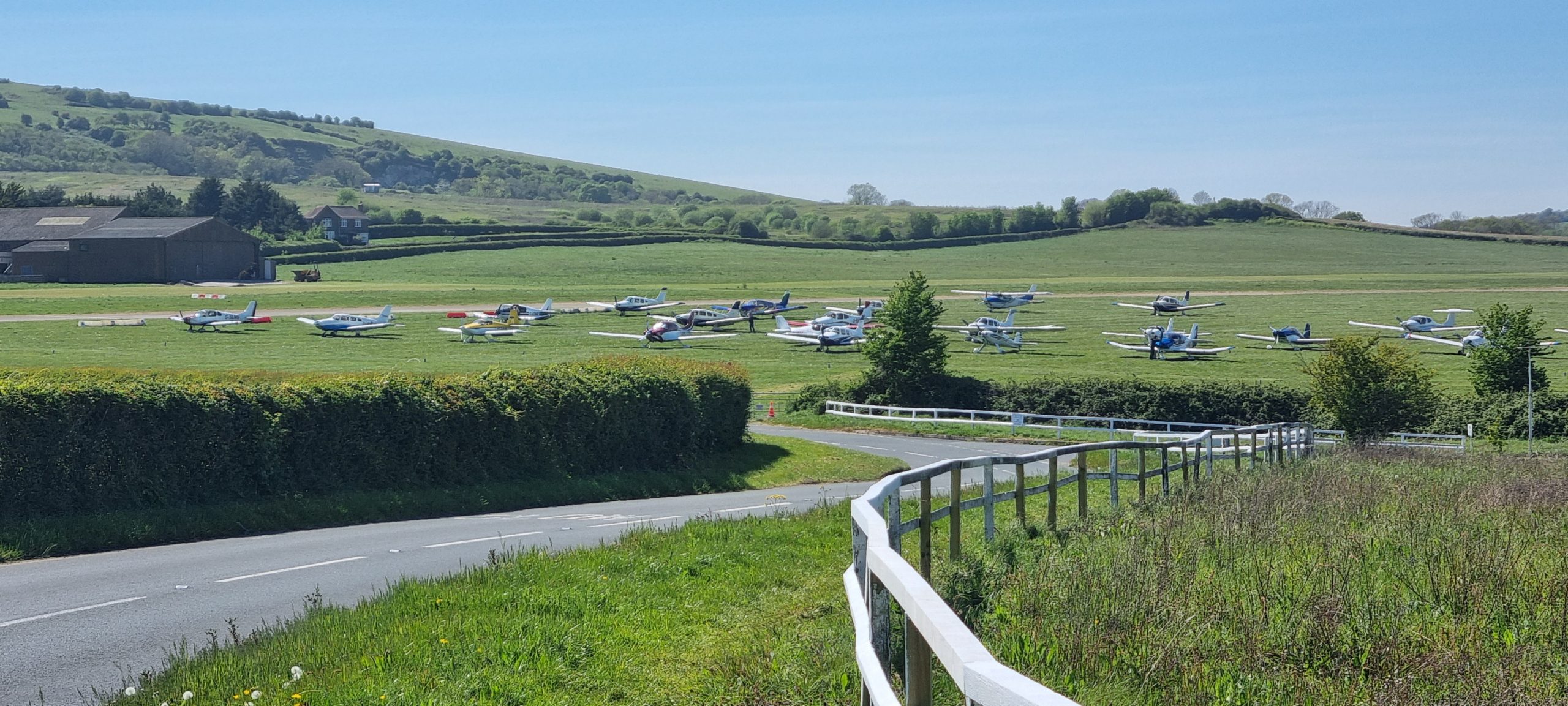
So once we’d met up, hugged and signed them in, we set off on a lovely walk down into Bembridge town proper, including a yummy lunch at the Harbour View Cafe. After wandering along the beach for a bit, we walked back up to the airfield. Many more aircraft had arrived by this time! Alpha-Mike is third from the left in the front row; David’s Golf-India is fifth from the left, next to the Canadian-registered aircraft to the right of Alpha-Mike.
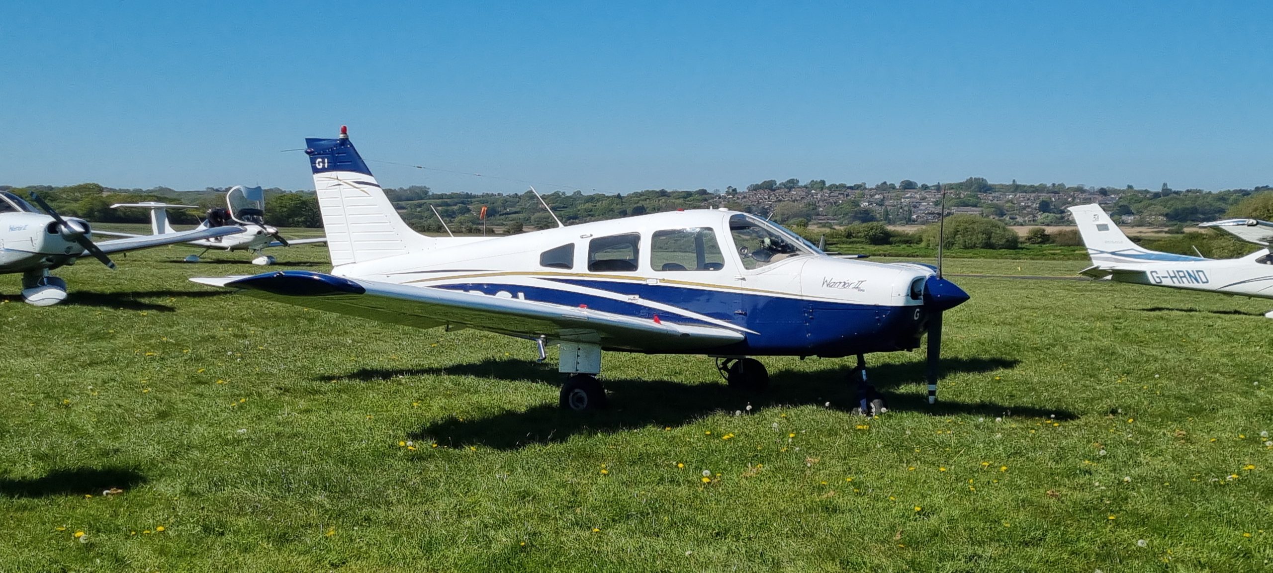
Here’s a close-up of David’s chariot for the day, the beautiful Piper PA-28 Warrior II, G-EDGI.
Now we were back at the airfield, we popped in for a lemonade at the adjacent Propeller Inn. Like I said, I had stayed on that caravan site next to the airfield in 2015 for two weeks, and since then I have always wanted to do a landaway there. Although there’s now that treeline we saw earlier blocking the view from the campsite, and the Propeller Inn is under new ownership – they have sacrilegiously removed all the aircraft models from the ceilings[22] and there was a bartender bot with absolutely no personality whatsoever; couldn’t even call him an NPC as he had no script – anyway things haven’t changed all that much over there. Things hardly ever change on the IoW, except that now they have a decent phone signal.
But we had to leave at some time, so we said our goodbyes and boarded our aeroplanes to fly home again.
Here’s the view down Runway 12, lined-up and just prior to beginning my take-off roll. This view is simply unbeatable:
Five minutes after liftoff and already at 3,000ft, here’s a view of Shanklin, IoW, with Sandown just to the right/East. Sandown airfield is visible in the centre of the photo. From up here, I could see the entire Island and the Solent, Portsmouth and Southampton all in one go. Simply stupendous.
Time for another scenic cruise around the south coast of the IoW, and here’s Ventnor Downs again. Note how much the visibility has improved. You can see for miles now.

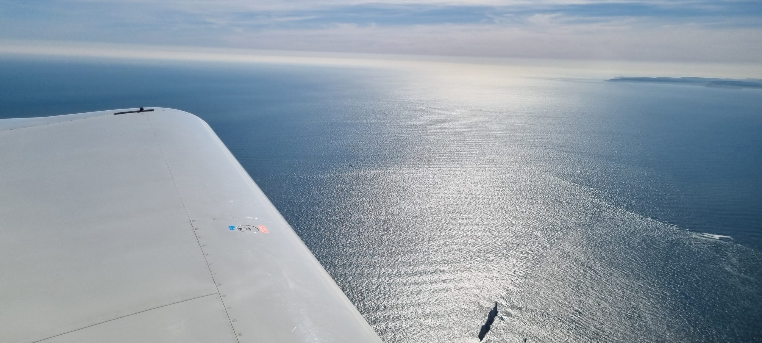
Coming up on The Needles again, the western tip of the Isle of Wight.
What happened next was almost unbelievable; one of those things that happens occasionally when flying. It was completely unexpected when the Bournemouth Radar controller, from whom I was in receipt of a radar service[23] suddenly called me up and said, “Golf-Alpha-Mike, traffic is a Spitfire, one thousand feet below you on a parallel heading. He’s probably headed for The Needles”. I heartily agreed that looking out for a Spitfire would be a great idea and she told me it was in my 2 o’clock low. So I looked and Tally-Ho! – I’d spotted him[24]; the Spit was very low on first sighting; as she said, about 1000ft below me, and I kept sight of him for about a minute then lost him in the background clutter. A minute or so later, I glanced at the Needles, which I was just passing, and there he was! The aircraft can be seen in this photo if you zoom riiiight in just left of centre, and just in front of my wing. As is always the case with amateur aerial photography, he was a lot closer in reality than he looks in the picture! This was very much a point-and-hope shot which fortunately worked out rather well. The black thing at the bottom middle of the photo is the Needles themselves. Can you see the Spitfire? What a great thing to have briefly shared airspace with such a legendary aircraft!
After my epic encounter, I still had to cross the Solent! Here’s Hengistbury Head coming up ahead. The black marks on the picture are the way in which the camera picks up the propeller blades whirling around.
Over Hengistbury Head, a lovely shot looking at early evening mist in the direction of Swanage. Poole Harbour to the right of the shot.

Swanage and Ballard Down, with Studland in the foreground. Look how clear the air is.
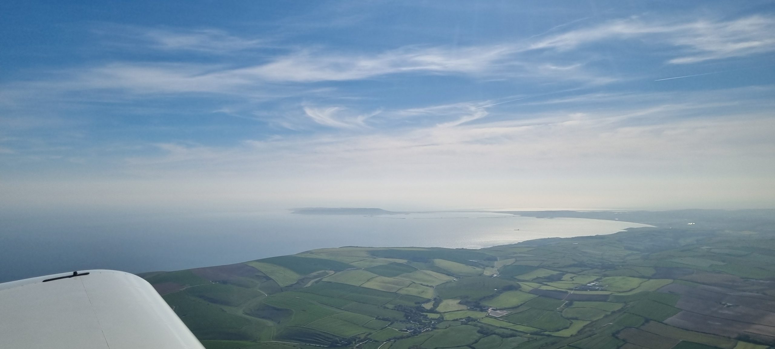
Portland Bill and Weymouth again. If you compare this photo with the one from the morning, you can see how much the visibility has cleared up.
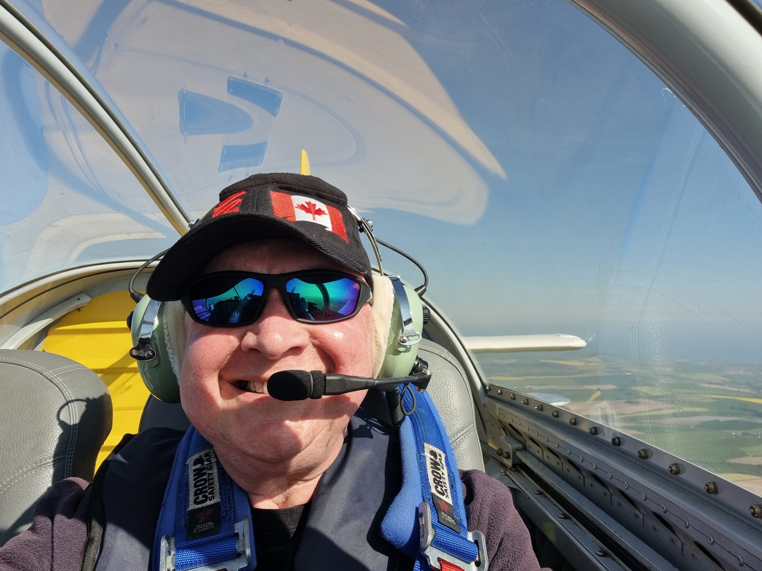
I don’t often do selfies but here’s me displaying the ‘RV-9A grin’. It’s going to take me a few days to lose that, I think. And there’s my Canada ball cap too:
Final shot of the trip, approaching Lyme Regis to my left. After this, things were a bit busy, so no more photos I’m afraid. Flying almost directly into a low-ish sun, with haze still present over home plate despite the clarity here, and trying to look out for other aircraft in that muck too, also trying to see my home plate at Exeter coming up. Certainly not a time to be mucking about with a camera, even with the autopilot in operation.
So, like I said, a lovely day out and it took me at least a week to lose the grin! And what an adventure, especially with the Spitfire sighting![25]
The RV-9 grin. What a lovely aeroplane and I am privileged beyond measure to be trusted with flying this little beauty. And also to have been able to share, in some small measure, my adventure to the Isle of Wight. Even now, over a week later, I am still enjoying flashbacks of the things I saw and experienced on that trip. I will go again this summer, I think!
Footnotes
| ⇧1 | She now lives at Lasham, home to one of England’s main gliding clubs. Given that she has a glider-towing attachment, I would not be surprised if it were the case that they were using her for that purpose. |
|---|---|
| ⇧2 | The aircraft’s name is given by the last two letters of her registration, so, ‘Golf Charlie Sierra Alpha Mike’, becomes ‘Alpha Mike’. |
| ⇧3 | The designer, Richard VanGrunsven, uses his initials to name his different aircraft designs, hence the initials ‘RV-9A’. The RV-9 is the tailwheel version; the RV-9A (like Alpha-Mike) is the tricycle version with the nose wheel |
| ⇧4 | Although, Van’s Aircraft do actually sell completed aircraft too. |
| ⇧5 | To put it politely 😉 |
| ⇧6 | I used to fly gliders back in 1991, with the Leeds University Gliding Society, but as that was affiliated with the RAF Gliding and Soaring Association, it was heavily subsidised and therefore very cheap. |
| ⇧7 | The sole minor exception is that she has only two seats rather than four, but that doesn’t really matter as I have very rarely flown a four-seater with a full load of passengers, and in any case the logistics of getting four people together to go flying all at the same time is quite something! |
| ⇧8 | Over the course of my flying ‘career’, I have flown something like fourteen different aircraft types, including four gliders (Grob Acro, Schleicher Ka-2, Schleicher K-7, Schleicher K-13) and ten powered types (Cessna 152, Cessna 150 Aerobat, Diamond DA-20 Katana, Piper PA-28 Warrior II, Piper PA-38 Tomahawk, Robin R2160, Ikarus C42, Sportavia RS-180 and of course the Van’s RV-9A). |
| ⇧9 | As opposed to 90kt (100mph) for a Cessna 152 and 100kt (114mph) in a Piper Warrior. |
| ⇧10 | ‘Leaning’ refers to the adjustment of the fuel/air ratio (the ‘mixture’) going into the engine, by using the red ‘mixture’ knob visible on the photos in this article. As the air density decreases with altitude, you can end up with too much fuel in the mixture – known as a ‘rich’ mixture – so you need to make the mixture more ‘lean’ (hence: ‘leaning’) in order to correctly match the proportions of air to fuel. The reverse happens as you come down; the air gets more dense so there will be too little fuel in the mixture (it will be too ‘lean’), so you need to enrich the mixture again using the mixture control. |
| ⇧11 | Having the VP prop also meant that the group’s Pilots had to have additional training to get the VP prop rating put on our licences, as we also had to for the Garmin EFIS (the Electronic Flight Information System or ‘glass cockpit’) too. So now we are all VP prop-rated and EFIS-rated Pilots as well as our basic Private Pilot’s Licences (and I have a Night Rating as well, of course). These ratings are lifelong and they mean that we can now fly any aeroplanes with VP props and/or EFIS avionics. |
| ⇧12 | This activates emergency glide protocols in the event of an engine failure, including turning the aeroplane towards the nearest airfield within gliding distance. Really clever! |
| ⇧13 | Taxying is the term used for driving an aeroplane around on the ground, as opposed to up in the air. |
| ⇧14 | Propeller wash, or ‘prop wash’, is the high-speed airflow around the aircraft’s fuselage caused by the propeller acting like a giant fan, which, I suppose, it is…. 😉 |
| ⇧15 | A ‘landaway’ is exactly what its name suggests: a landing away from your home base. Most private pilots’ sport flying careers consist of simple local jaunts where they take off from their home plate, fly around the local area a bit, and then return to the place they set off from. A landaway is where you fly out to another aerodrome and buy a coffee, lunch or breakfast, then fly back to base after you’ve had a wander around on the ground at your landaway destination. With G-VIZZ, one of my favourite landaways was the short grass strip at Bolt Head near Salcombe, Devon. I’d land there, go for a lovely cliff-top walk, then return to the airfield and hop back into the aeroplane to fly back to base at Exeter. |
| ⇧16 | Where you’ve crashed 😉 |
| ⇧17 | The sea! |
| ⇧18 | The blue hangar in the middle distance, to the left of centre, is the hangar in which we built the aircraft. |
| ⇧19 | I could really get used to that autopilot! |
| ⇧20 | For those who are used to interpreting a Garmin G3X display with autopilot, you may be wondering why the autopilot is executing a descent when we are below the requested/preset operating altitude. That’s simply because I am still learning to drive the thing; using an autopilot is not as simple as just pressing a button and it takes over. Well, not once you get under the hood, anyway. I had sorted it all out within a few minutes! |
| ⇧21 | Everyone knows that light aeroplane engines are powered by a hamster running on a little wheel, under the engine cowling; this makes the propeller go round very fast. |
| ⇧22 | Sacrilegious, because how can you have a pub right next to an airfield, keep its name as the Propeller Inn, have a giant propeller stuck on the outside of it, and then remove all the pre-existing model aircraft from the ceiling in the bar?? Seriously, someone needs to be shot for that! |
| ⇧23 | A radar service is basically where the radar station has you on their screen; they keep a lookout for other aircraft in your vicinity and warn you if there’s any chance of getting too close to each other. No substitute for keeping a good lookout, of course, but it does add an additional layer of safety. It’s like having an extra pair of eyes. |
| ⇧24 | Tally-ho! was the code word adopted during the Battle of Britain in 1940, which RAF airmen used to tell their radar controller that they’d seen the aircraft (usually enemy!) that they’d been vectored to intercept. While it is not correct radio procedure nowadays to use ‘Tally-ho!’, still I do use it occasionally and they know what I mean 😀 I think I used it on this day, but I can’t remember for sure! |
| ⇧25 | Only twice in the past have I seen anything similar; on both those occasions I was flying in the same bit of airspace as the legendary Red Arrows. Once was in 1991 at RAF Dishforth near Ripon, where I used to fly gliders with the Leeds University Union Gliding Society, which was affiliated with the RAF Gliding and Soaring Association. Just as I was completing a winch launch at about 1000ft above ground, two Red Arrows Hawk jets flew over me about a thousand feet higher up and going in the opposite direction. There was an air display going on that day at RAF Leeming, ten miles further up the A1. So I could legitimately say I’d flown with the Red Arrows! 🤣 The second time was a couple of years after I got my licence. On one day in August 1999, I was flying solo circuit practice at Plymouth Airport when a voice came over the Tower frequency, “Plymouth, good afternoon, The Red Arrows!”. Tower was unfazed. “Station calling Plymouth, say again your callsign”. So funny. I’m afraid I don’t think he’d misheard, nor was it that he couldn’t believe his ears; I think he was trying to wind them up. I suppose you had to be there. Anyway, the unflappable Red One calls back, “Plymouth – The. Red. Arrows! Crossing ten miles north abeam your airfield”. And so both I and the controller looked, and there they were, a close group of little aeroplane-shaped dots in the distance which were nevertheless, very distinctly, red. I think they were on their way to display at Fowey in Cornwall, they do tend to display there at least once a year even to this day – although last year (2025) it was at Falmouth. |